Multi-Day Hiking Tours

trek-mi-gran-paradiso-national-park-hiking-nivolet

GRAN PARADISO NATIONAL PARK – 3 days Hike – Level MODERATE

GRAN PARADISO NATIONAL PARK – 3 days Hike – Level MODERATE 2560 1920 TrekMI

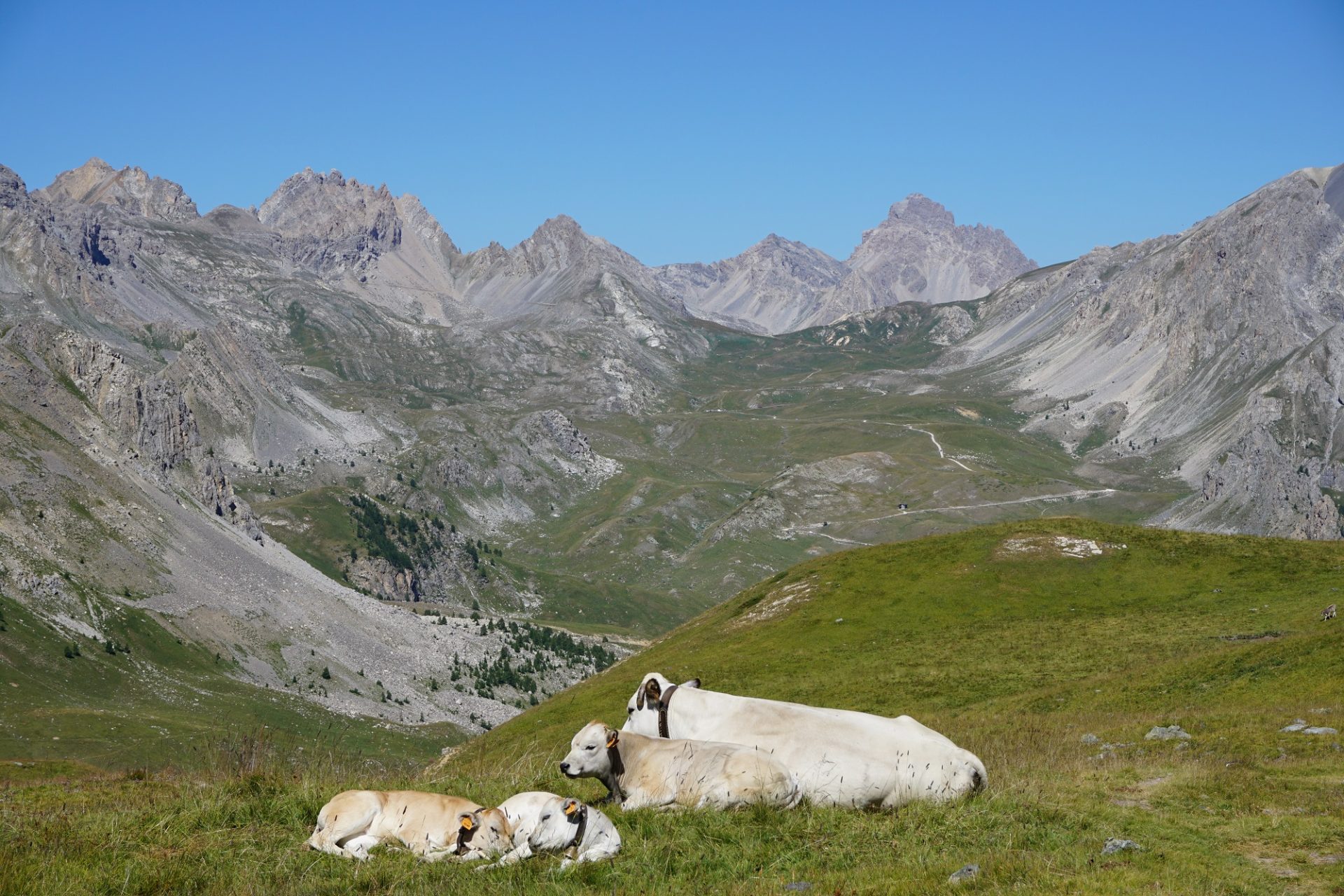
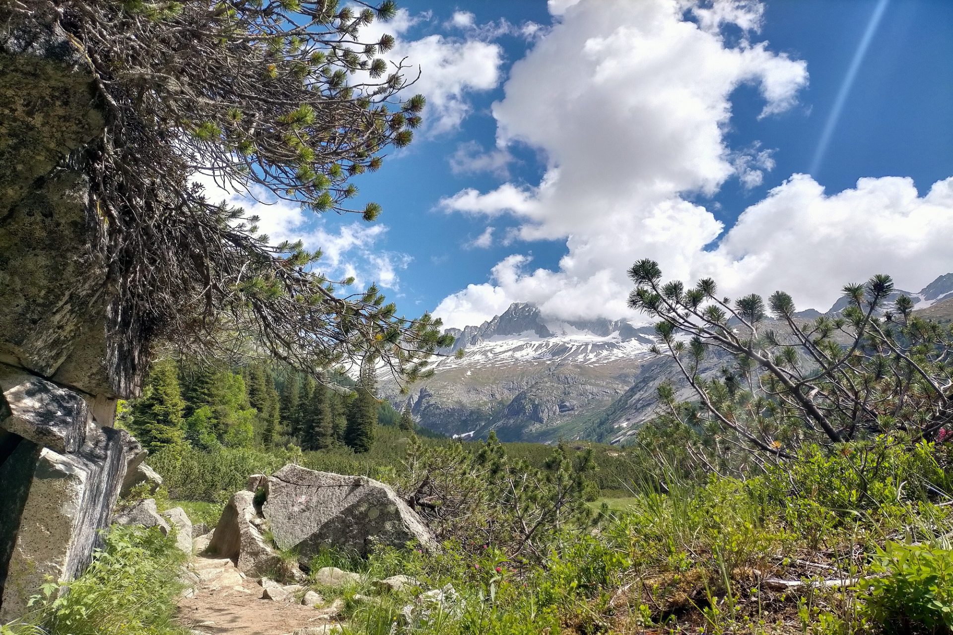
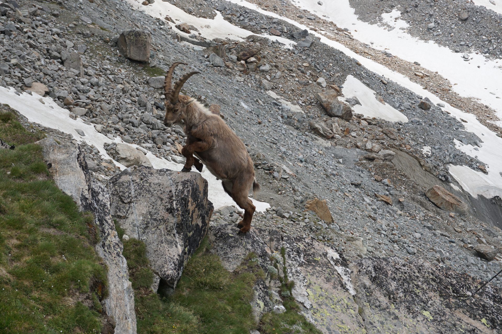
There’s one place in Italy with the highest concentration of alpine ibex and alpine chamois. It’s called the Gran Paradiso National Park and is the “Grandpa” of all Italy’s protected areas, both in name and in fact. Gran Paradiso (the “Great Paradise”) was indeed the first one to be recognised as a National Park in 1922 and still today survives as a protected area for research and conservation of wildlife and alpine flora.

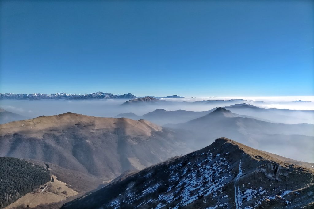
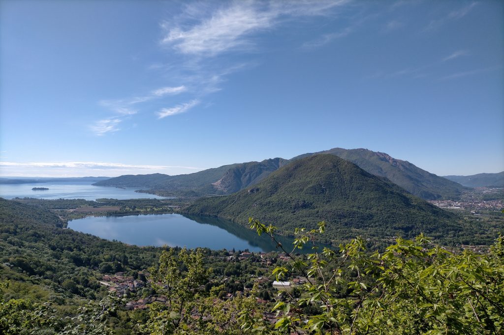
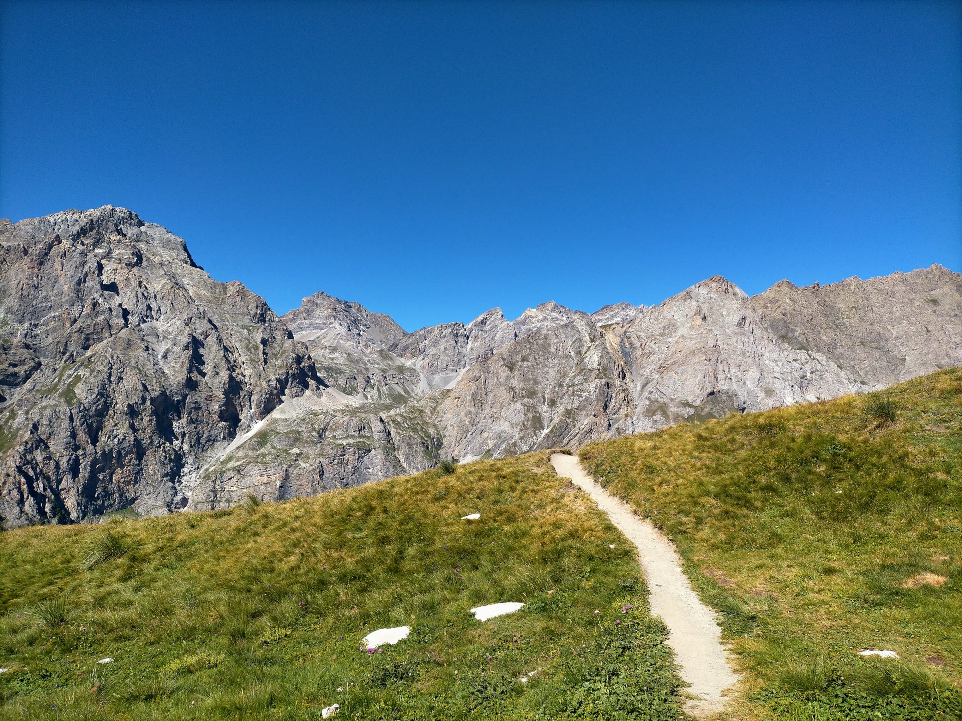
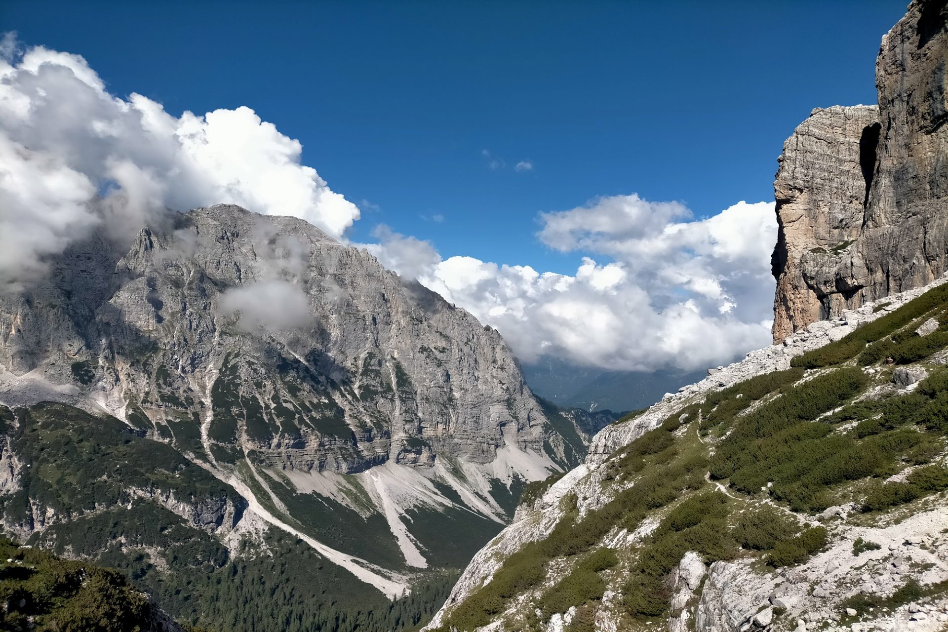
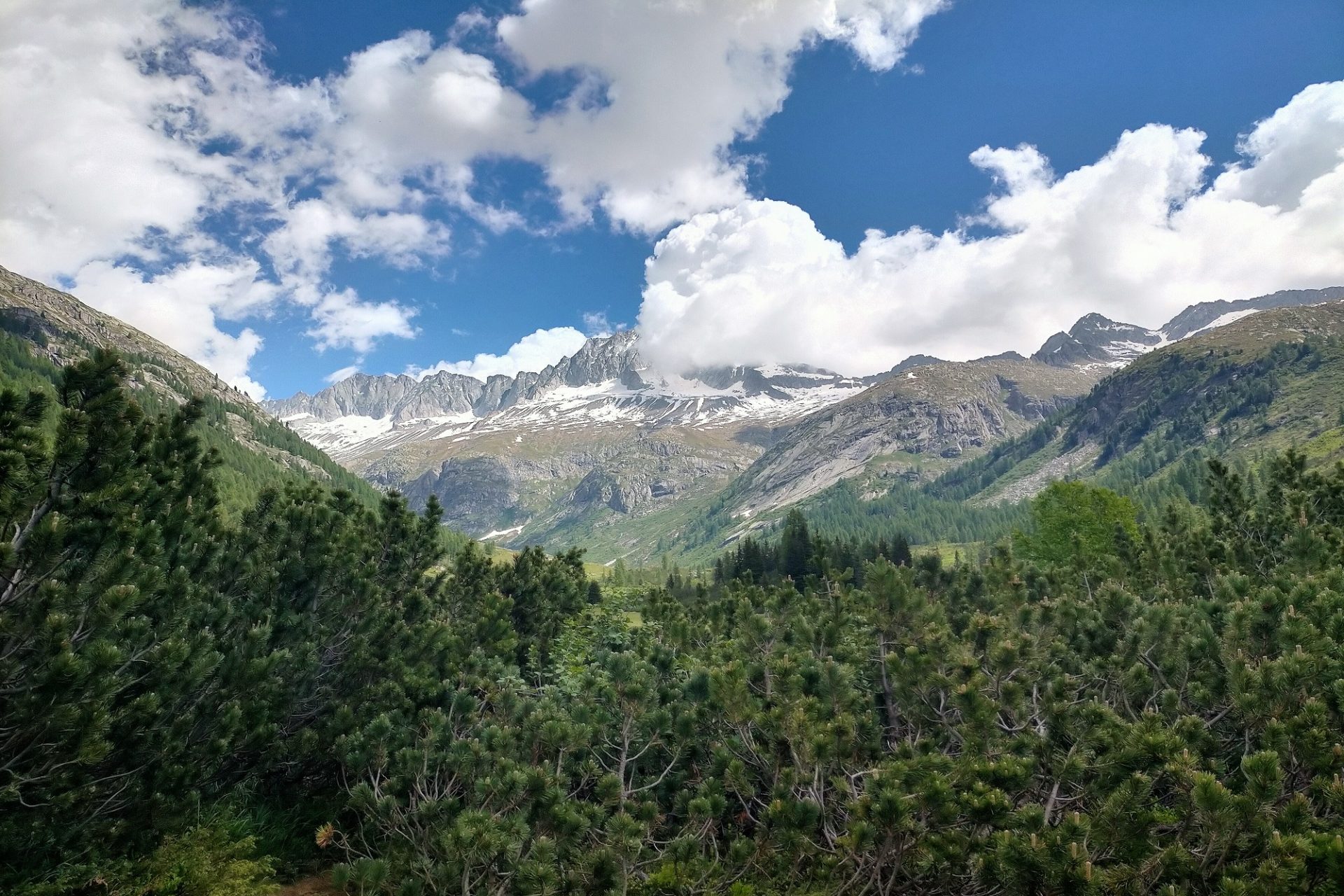
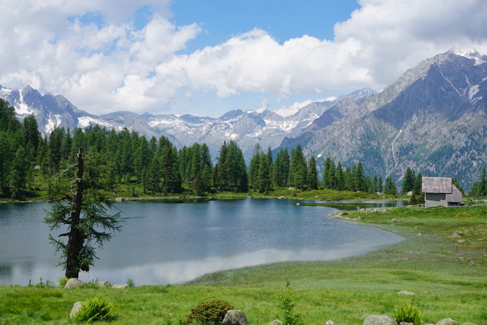
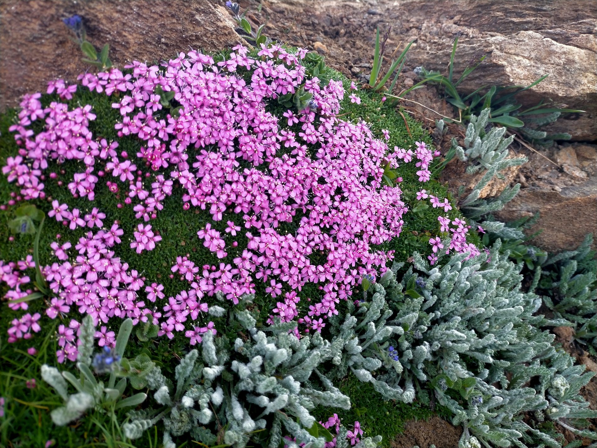
70,000 hectars of jagged mountains, extensive glaciers, larch trees and fir forests, lush alpine meadows and glistening glacial lakes divided between the Aosta Valley and Piedmont regions. An amazingly varied territory comprising five valleys that stretch around the Gran Paradiso Massif which is the only mountain over 4,000 meters entirely within the Italian border. A fascinating land, which for years has been the Royal Hunting Reserve of the italian former kings. Today instead, the perfect getaway for hiking and nature lovers seeking for peace and majestic views!

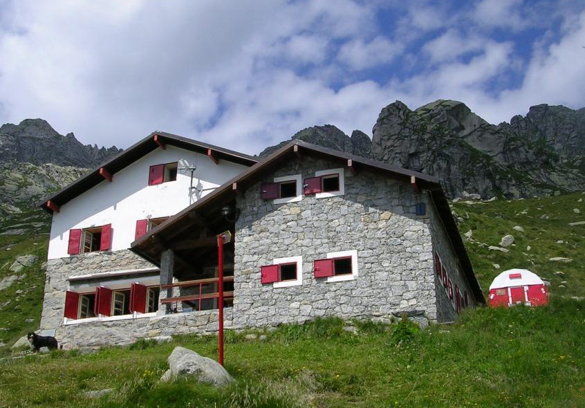
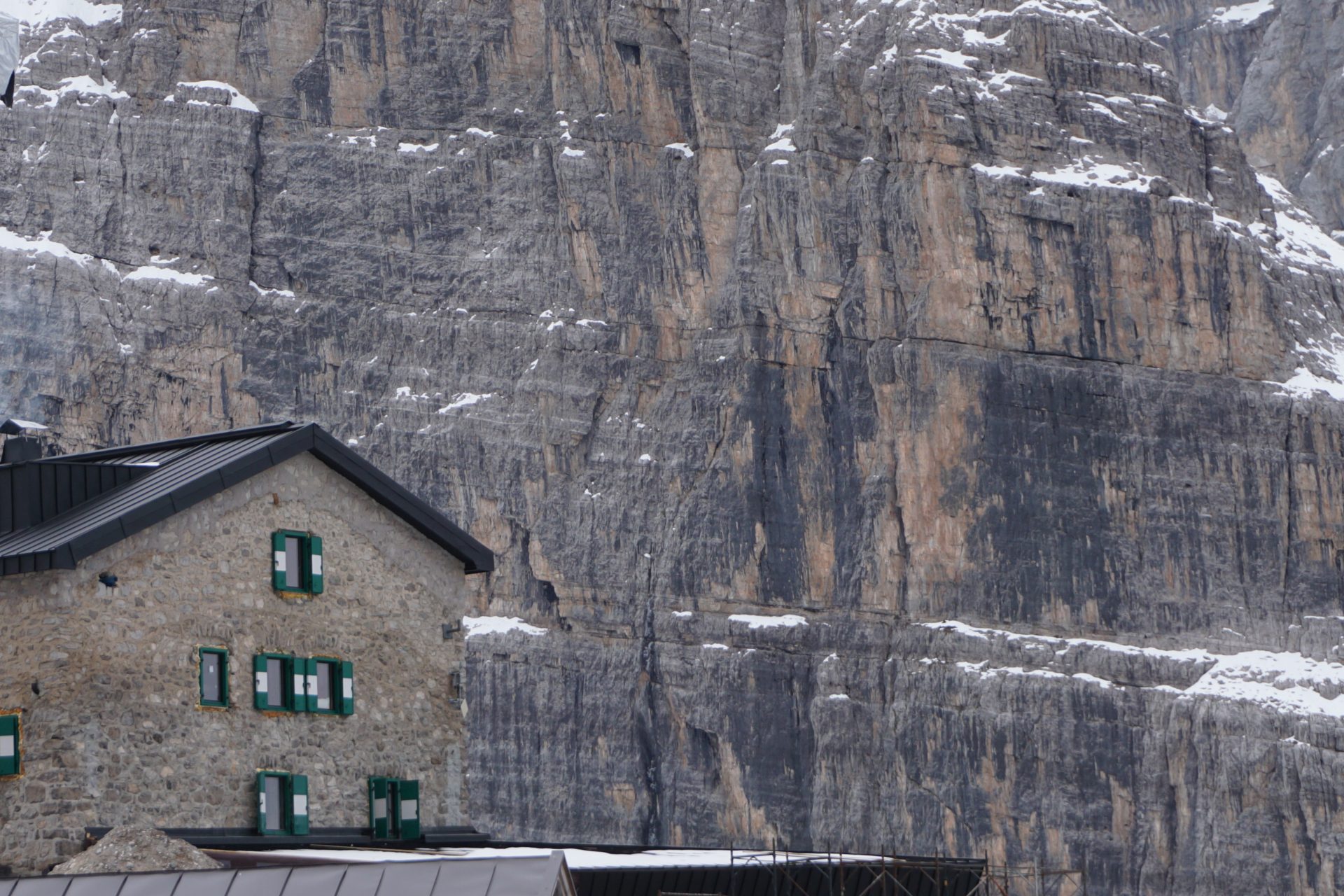
Our itinearary develops in the southern portion of the National Park – the one included in the region of Piedmont – using as a base the Savoia or Chivasso Hut. Rooms may be shared depending on availability. Shared bathrooms.

Day 1 – Jervis Hut and Nivolet Pass
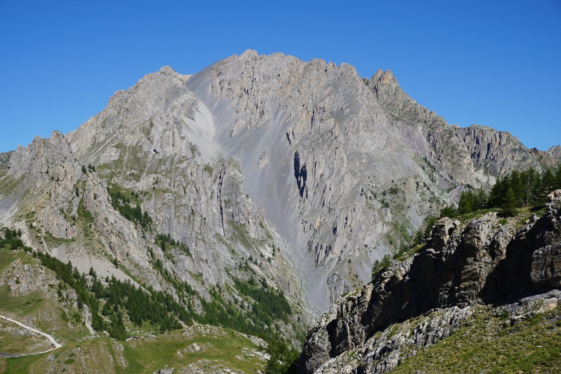
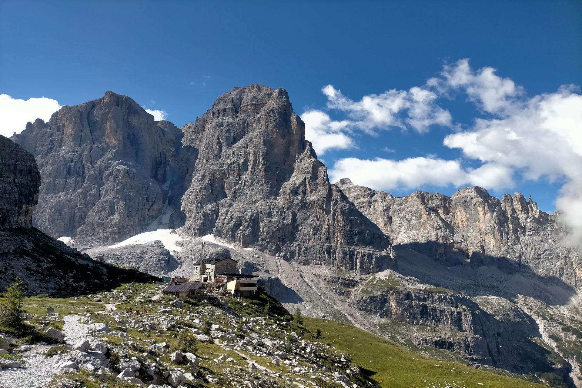
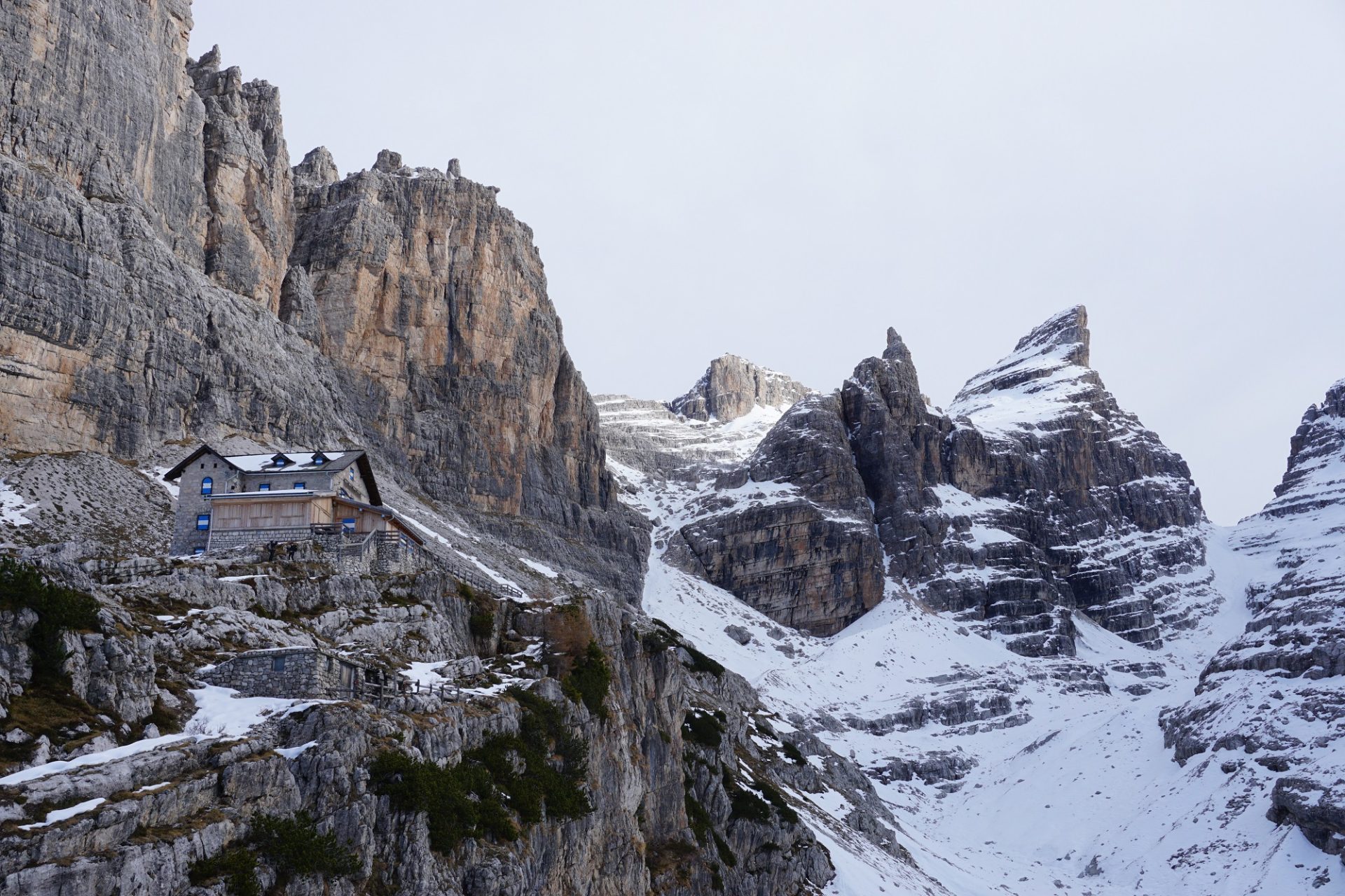
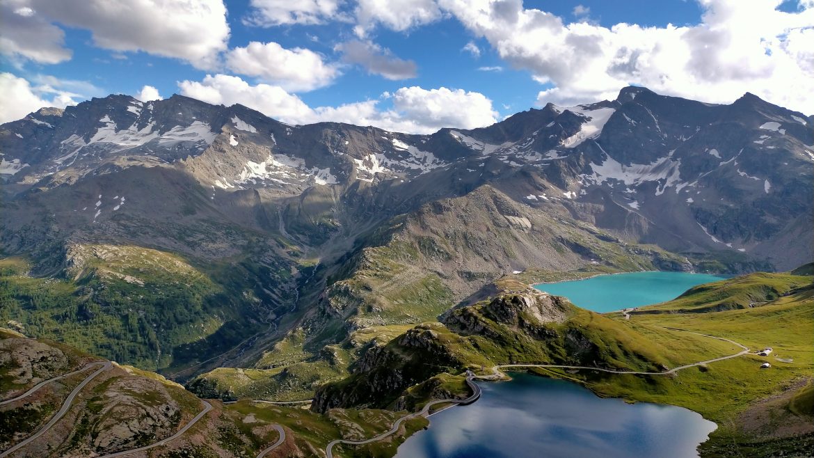
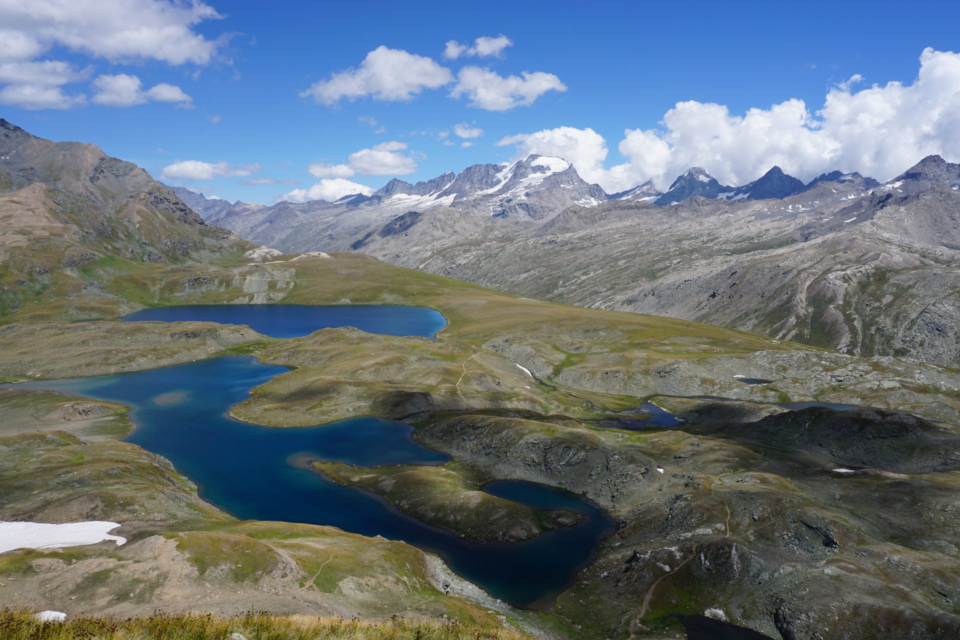
We leave early the city of Milan heading towards the village of Ceresole Reale located in the Orco Valley (3h), our gate to the Gran Paradiso National Park. We start our day hiking to the Jervis Hut, set at the foot of the Levanne mountains, peaks of over 3.000 metres. Lunch in the mountain hut enjoying the traditional cusine. After getting back to the car we start the very scenic drive to the Nivolet Pass (2.651m/8,700ft) along one of the most spectacular mountain roads you could ever imagine. The scenery is stunning from start to finish. A winding road, one of a kind, that snakes at the side of two turquise and blue lakes in a picture perfect mountainscape. After crossin the pass we reach the hut that will be our home for the next two days.

Day 2 – Basei Pass
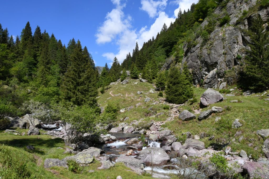
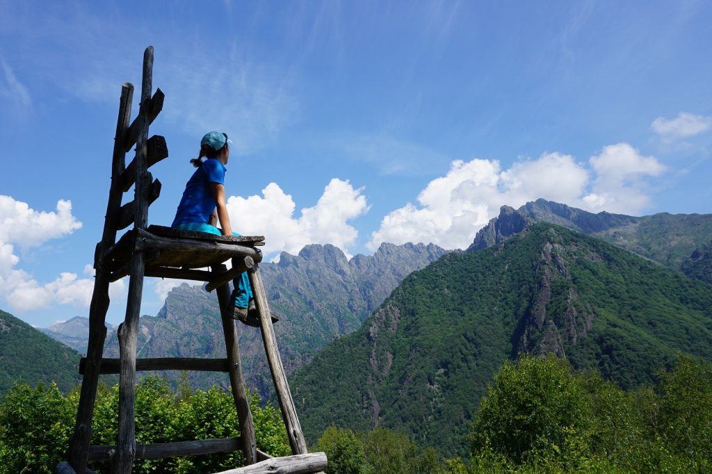
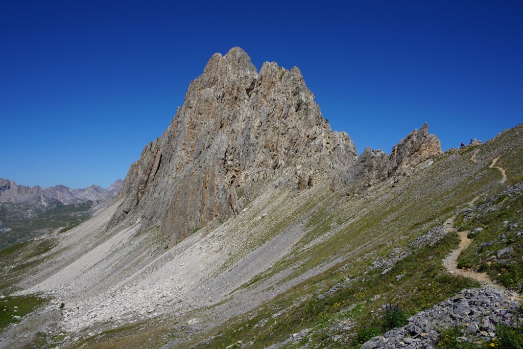
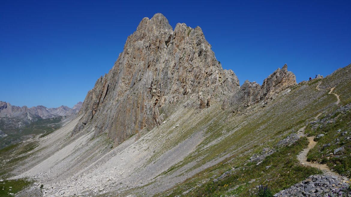
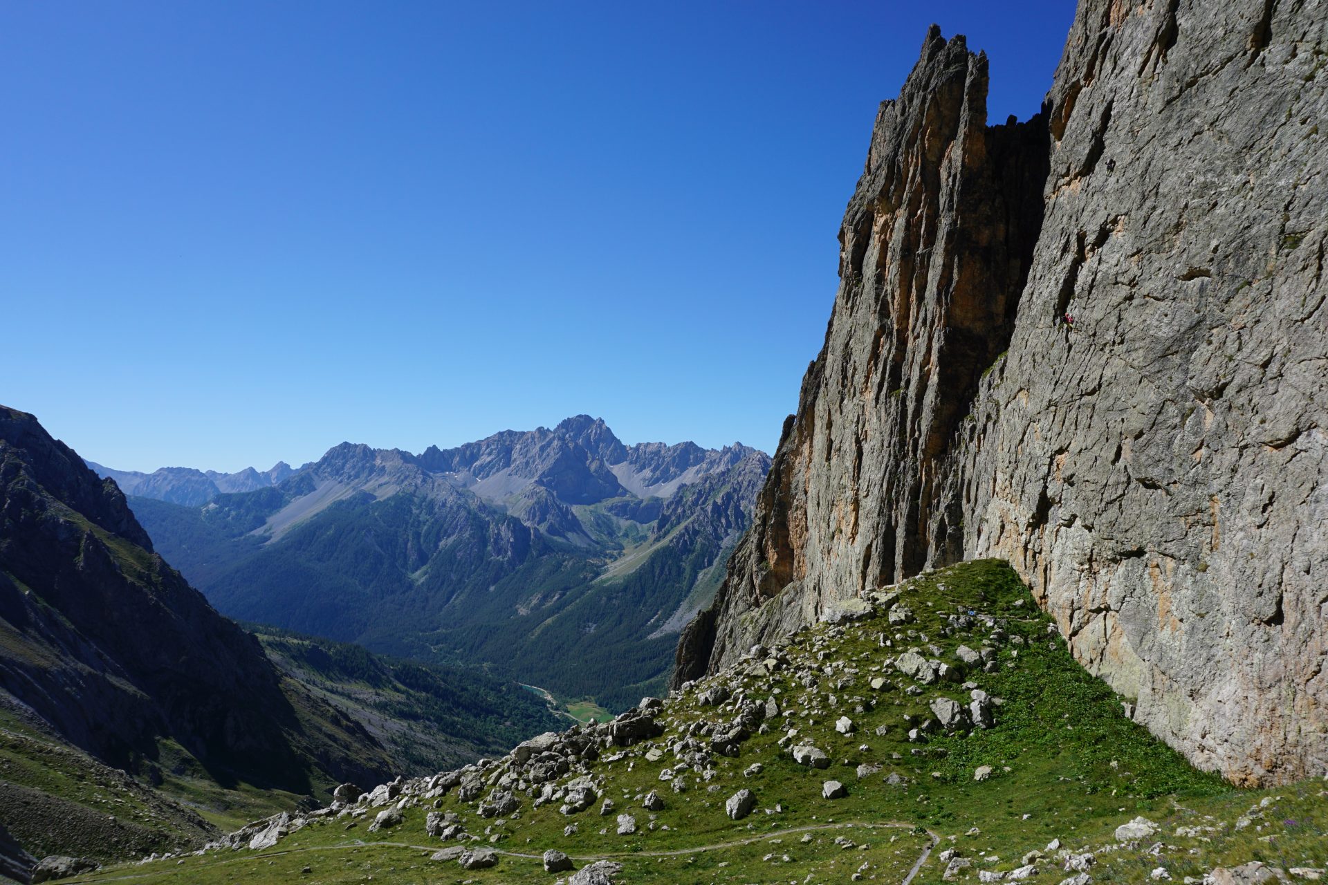
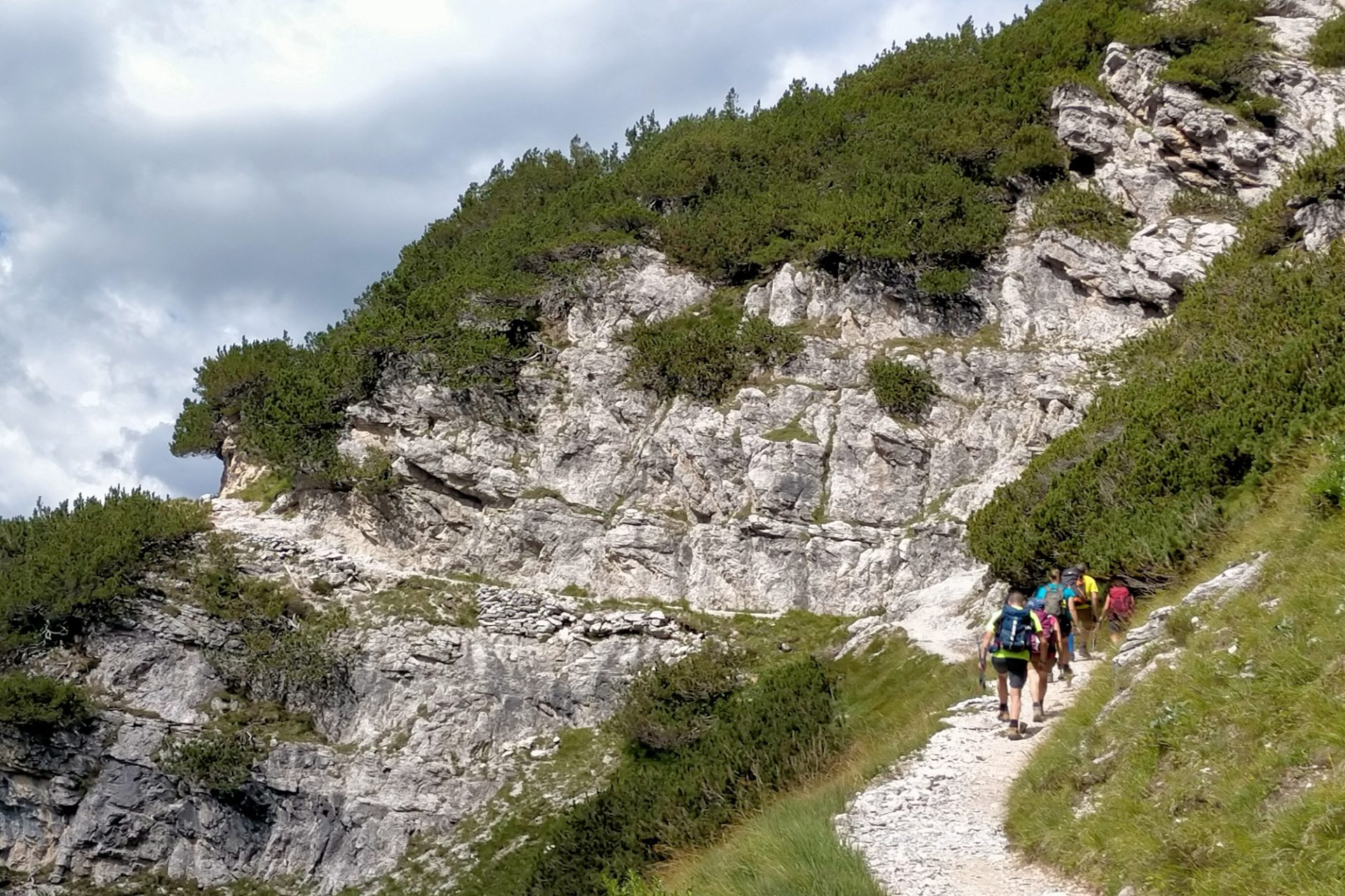
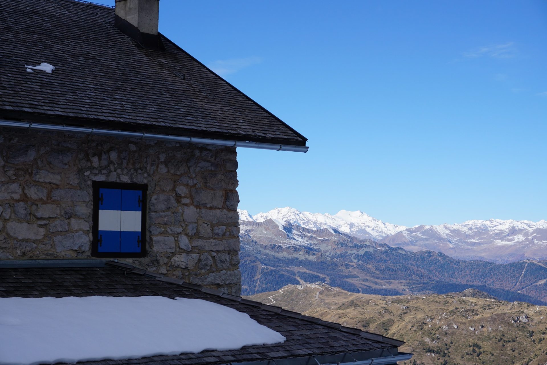
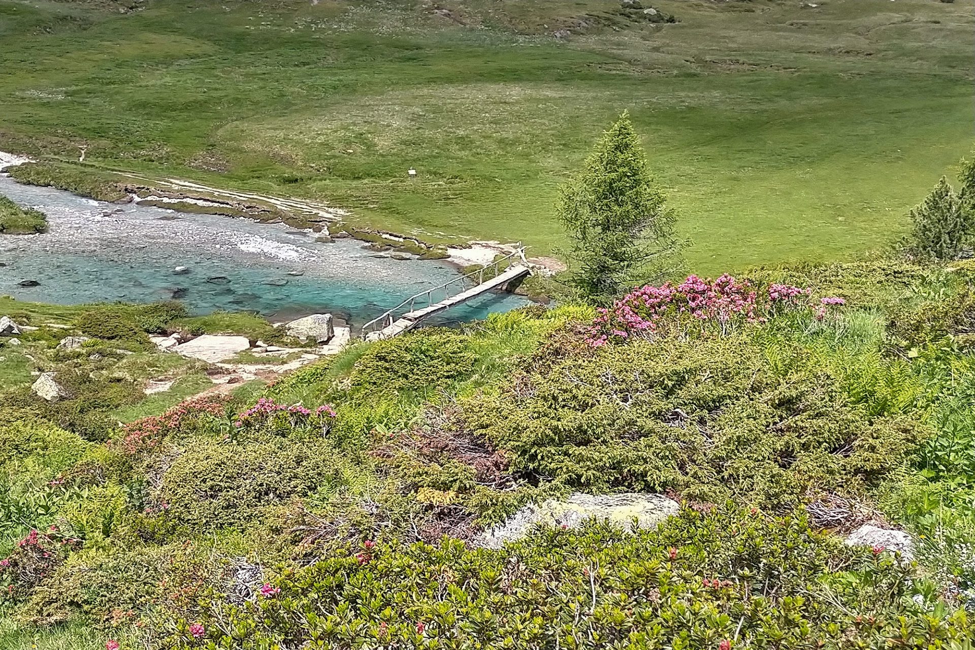
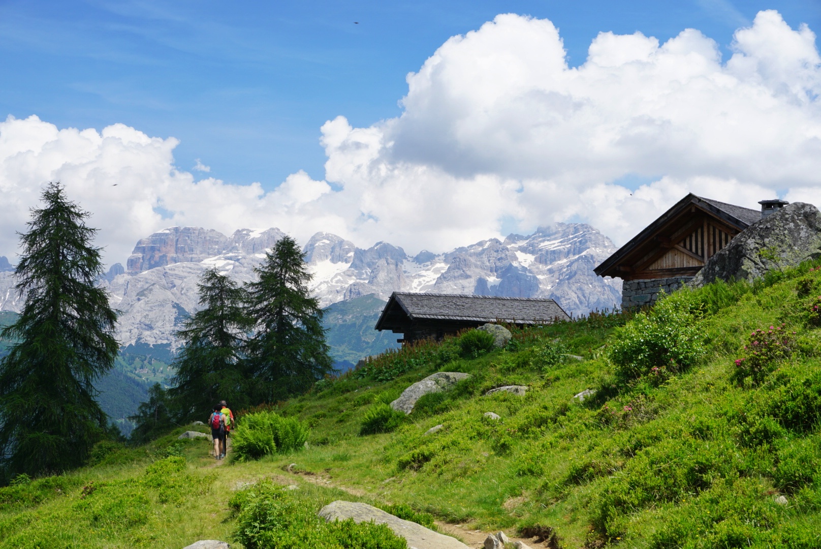
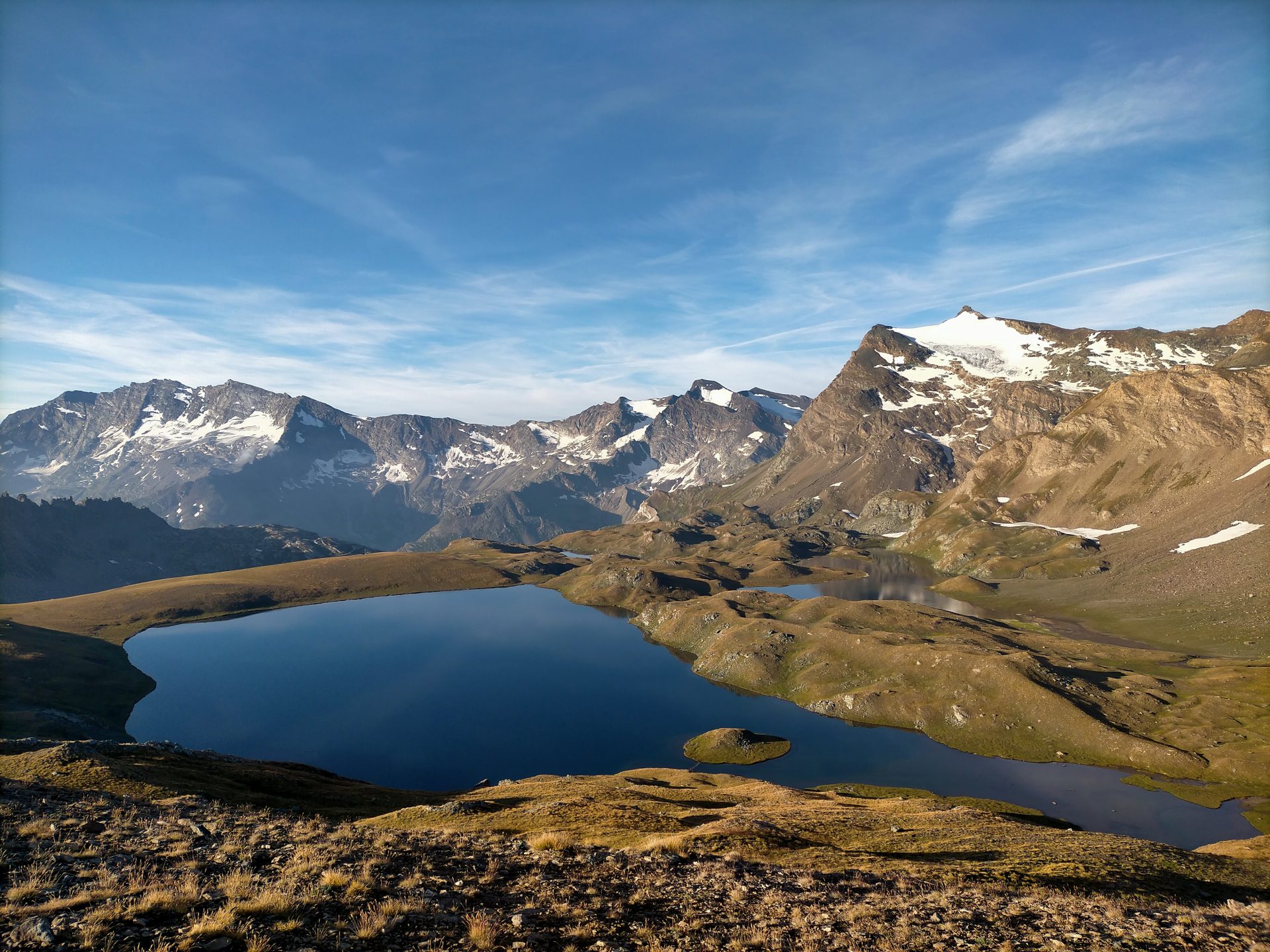
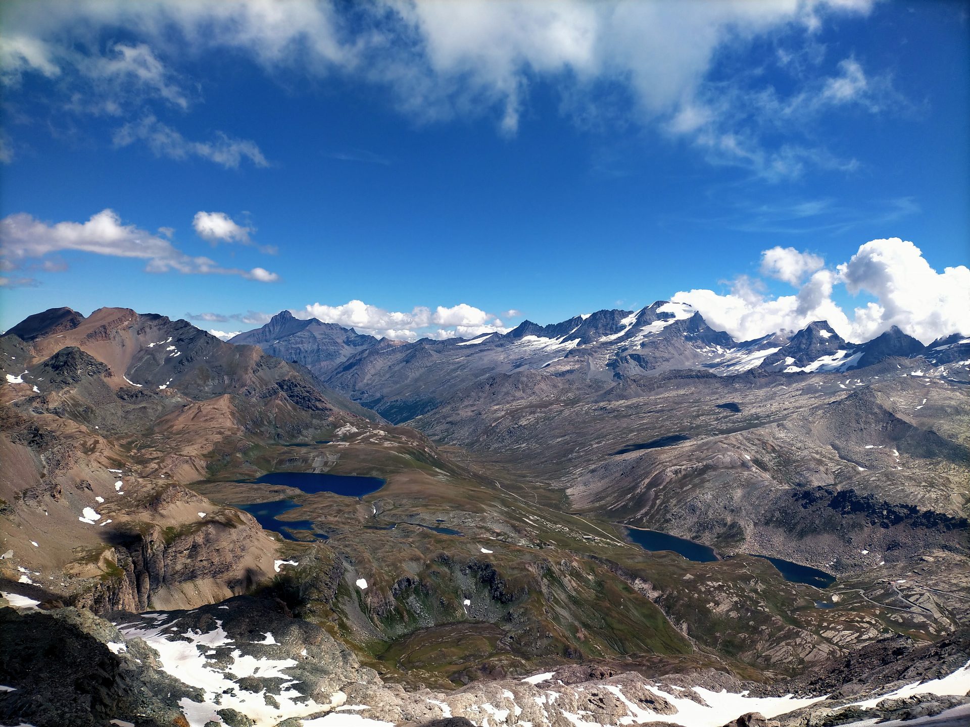
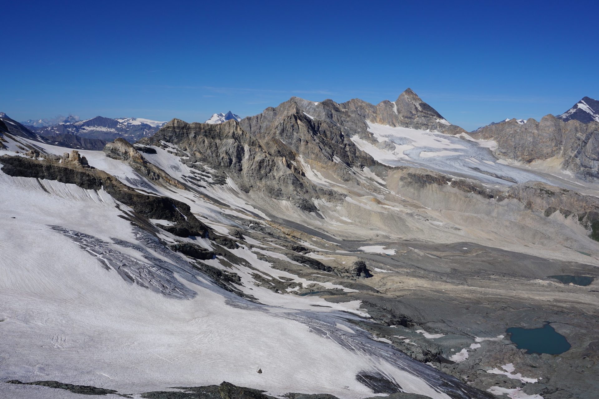
A day out exploring the westernmost part of the National Park and aiming at the Basei Pass (3.175m/10,400ft), a balcony overlooking the peaks and glaciers on the border with France. We start our hike reaching the higher meadows just above our hut and the crystal-clear water of Lake Leytà. From here we continue walking up on stony ground till the base of the Basei Peak (reaching the summit is optional). The landscape is lunar-like. A real spectacle for the eyes that can see as far as Mont Blanc and, of course, Gran Paradiso.

Day 3 – Lenyr Pass
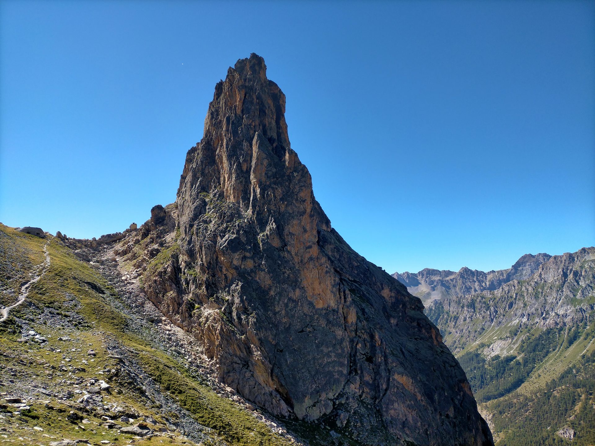
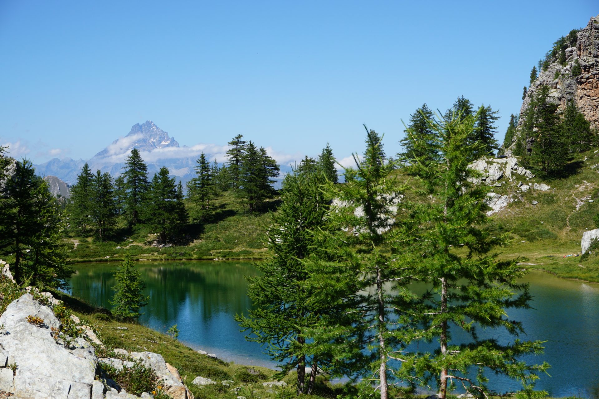
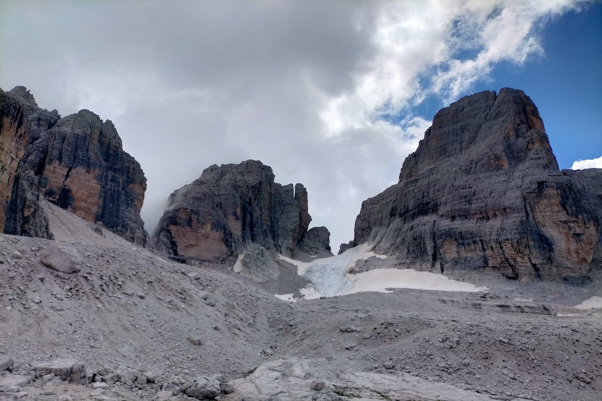
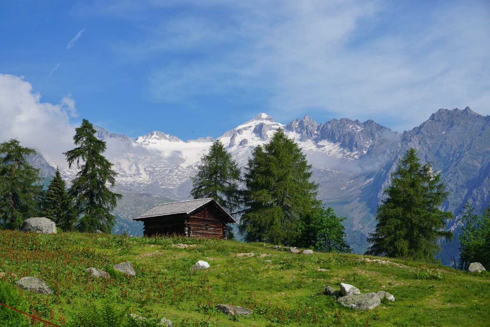
From the hut we start hiking northbound in direction of beautiful Lake Rosset and from there again north all the way to the pass that marks the border between region Piedmont and Val d’Aosta. The Lenyr Pass takes the name from the adjacent pyramid-like mountain, Lenyr Peak. Down on the other side the view opens up to the green valleys of Val d’Aosta and Mont Blanc. Again a spectacular view in one of the most spectacular corners of Italy! Always keeping our eyes open and ready to spot some wildlife we start our descent planning to be back at the hut in time for lunch. In the afternoon we start our drive back to the city of Milan.

BEST SEASON: july to end of september, avoiding weekends

WHAT TO EXPECT
TRIP TYPE: 
Multi-Day Hiking Tour
TRIP LENGTH: 
3 Full Days
DRIVING TIME FROM MILAN:
2.5 hours – Let us know if you’re staying somewhere else and still want to organize the tour with us. We can meet you on the way!

DAY 1
DIFFICULTY LEVEL: MODERATE
– Click HERE to understand the Hiking Difficulty Levels
DISTANCE:
8 kms/4.9 mi
ELEVATION GAIN:
620 m/2,034 ft
HIGHEST ALTITUDE:
2.250 m/7,381 ft
LUNCH: 
mountain hut
OVERNIGHT STAY: mountain hut

DAY 2
DIFFICULTY LEVEL: MODERATE
– Click HERE to understand the Hiking Difficulty Levels
DISTANCE:
8 km/4.9 mi
ELEVATION GAIN:
  650 m/2,132 ft
HIGHEST ALTITUDE:
3.175 m/10,416 ft
LUNCH: 
packed lunch
OVERNIGHT STAY: mountain hut

DAY 3
DIFFICULTY LEVEL: MODERATE
– Click HERE to understand the Hiking Difficulty Levels
DISTANCE:
10,5 km/6.5 mi
ELEVATION GAIN: 650 m/2,132 ft
HIGHEST ALTITUDE:
3.093 m/10,147 ft
LUNCH: 
mountain hut

Private tours are only open to your party
20% discount on the total price for families with kids and parties of 3 and 4. For bigger groups please ask for quote.

GEAR NEEDED: check the list of Things to Bring on a Hut to Hut Multi-day Trek

IMPORTANT: we run our tours in almost all weather conditions and very rarely cancel. See our Terms and Conditions for information on cancellations and refunds

YOU MIGHT ALSO LIKE…

GENEROSO PEAK – Day Hike – Level MODERATE
Monte Generoso is the highest mountain in Val d'Intelvi, a valley that stretches from the italian little village of Argegno - located on the western branch of Lake Como - in direction of Switzerland. A peak overlooking Lake Lugano and that offers spectacular views over the surrounding valleys and mountains. Reaching Generoso Peak means crossing [...]
SANGUIGNO VALLEY – Day Hike – Level EASY or MEDIUM
Val Sanguigno is the valley of water. An unspoiled natural paradise crossed in all its lenght by the stream of the same name which, gathering numerous tributaries, creates waterfalls and crystalline pools. A valley to go through without a precise destination, simply enjoying the hike and the luxuriance of nature, in one of the best [...]
SAN FRUTTUOSO FROM CAMOGLI – Day Hike – Level MODERATE
As wonderful as a mirage, the Abbey of San Fruttuoso, dating back to the 10th century A.D., is the most secluded of all the highlights hidden in the Natural Park of Portofino. Accessible only by boat or via hiking trail on the Portofino peninsula, this enclave, with a small cove beach and a green-blue sea, [...]
LAKE MAGGIORE – Day Hike – Level MODERATE or DEMANDING
Todum Peak is one of the most panoramic mountains overlooking Lake Maggiore to the south and the Val Grande National Park to the north. A loop itinierary for a 360° view that embraces an area of great beauty, including the gulf of the Borromean Islands and the peaks of the Monte Rosa massif. A car-free [...]
LAKE MAGGIORE – Day Hike – Level MODERATE
Mount Faiè is a privileged panoramic balcony over the Maggiore, Mergozzo and Orta lakes but also over the rugged mountains of the Val Grande National Park and the peaks of the Monte Rosa massif. Mount Faiè, albeit with its modest altitude, offers a spectacle as far as the eye can see. From the small rural [...]
LAKE MAGGIORE – Day Tour by Boat and Train
A memorable tour to discover the most famous highlights of Lake Maggiore, Italy's second biggest lake. From Milan we catch a train to Stresa (1h), our gate to the enchanting gulf of the Borromean Islands. A group of three gorgeous tiny island - Isola Bella, Isola Madre and Isola dei Pescatori - named after the [...]
VAL GRANDE NATIONAL PARK – Day Hike – Level DEMANDING
An itinerary that takes you straight to the heart of the Val Grande National Park, the most extensive wilderness of both Italian and European Alps. Thousands of hectares of mountains abandoned by man that nature has been slowly reclaiming over the past fifty years. A treasure to be preserved, that holds the memories of an [...]
VAL GRANDE NATIONAL PARK – Day Hike – Level MODERATE
Corte Buè was one of the most populated pastures in the Val Grande National Park, the most extensive wilderness of both Italian and European Alps. Thousands of hectares of mountains abandoned by man that nature has been slowly reclaiming over the past fifty years. A treasure to be preserved, that holds the memories of an [...]
MAIRA VALLEY – 3 days Hike – Level MODERATE
Val Maira is one of the most remote and peaceful of Italian valleys. So it is no surprise if most people have never heard of it. Yet Val Maira is absolutely stunning. A valley for connoisseurs who love dreamy landscapes, breathtaking views and authentic ancient traditions. A valley where not only sports enthusiasts, but also [...]
VAL MASINO EXPLORE – 2 Days Trek – Level DEMANDING
Located in the very central part of the Italian Alps and framed by those high mountains that divide it from Switzerland, Val Masino is, with good reason, one of the most beautiful italian valleys. The "land of granite"- as everybody calls it - is a paradise for rock climbers but also for those enthusiastic hikers [...]
trek-mi-val-maira-hiking-rocca-la-meja

MAIRA VALLEY – 3 days Hike – Level MODERATE

MAIRA VALLEY – 3 days Hike – Level MODERATE 2560 1707 TrekMI

Val Maira is one of the most remote and peaceful of Italian valleys. So it is no surprise if most people have never heard of it. Yet Val Maira is absolutely stunning. A valley for connoisseurs who love dreamy landscapes, breathtaking views and authentic ancient traditions. A valley where not only sports enthusiasts, but also families with children can find plenty of options to enjoy. In short, there’s definitely more than one reason for you to visit!

Located in the Piedmont region, in the province of Cuneo and stretching towards the border with France, Val Maira is an open book of history and geology. An amazing land where Dolomites-like rugged peaks emerge as islands from the grasslands, remnants of the fascinating past of completely different sceneries.

Val Maira also means Occitan culture. The language, the architecture and the cuisine here are very unique. The inhabitants of the valley are taking good care of their important heritage and are always ready to share it with their new guests. Staying overnight in one of the traditional lodges and tasting some great local food is a must for the ones reaching from Milan. Something that no doubt will make your experience unforgettable.

Day 1 – Black Lake
We leave early the city of Milan heading towards Val Maira (4h). The drive is long but scenic, taking us across the wine regions of Langhe-Roero and Monferrato. Our first call is the little village of Pian Preit where we’re planning to have lunch and getting familiar with the traditional local cusine. In the afternoon we set off for an uphill hike to the Black Lake, nestled amongt beautiful mountains and at the edge of the tree line. In a distance we can admire the pyramid-perfect shape of the Monviso Mountain, reffered to as the “stone king”, the highest one in the area (3.841m/12,600ft). Overnight stay in a traditional lodge down in the valley (depending on availability at the moment of reservation).

Day 2 – Rocca La Meja
The mountain symbol of Val Maira is Rocca La Meja, a pyramidal shaped mountain mostly composed of dolostone, that stands out from the Meja-Gardetta green plateau. A vast land used as a high altitude pasture for the Piedmontese white cows, a breed of domestic cattle that originated in the region of Piedmont. Such an idyllic landscape! Our plan is to hike around the base of the mountain to the eastern face where a short trail takes us higher to its side, reaching a view point from where we can get get the best perspective of it. From here we can then retrace our steps back or extend the itinerary to complete the loop around the mountain. The second option is more demanding in terms of height difference and lenght. Overnight stay in a traditional lodge down in the valley (depending on availability at the moment of reservation).

Day 3 – Rocca Provenzale
We start early and by car we reach the little village of Chiappera, located at the very end of Val Maira. The town is dominated by the incredible spur of the Castello-Provenzale group – a paradise for climbers – which in fact represents its symbol. We start our excursion by reaching its slopes and, after crossing the Greguri Pass (2.317 m/7,601 ft), we continue hiking all the way around it. The landscape is magnificent. On the way back the path crosses enchanting meadows and get closer to the Stroppia waterfalls, the highest in Italy. The best month to observe them is june, when the water is more abundant. In the afternoon we start our drive back to the city of Milan (4h).

BEST SEASON: end of june to october

WHAT TO EXPECT
TRIP TYPE: 
Multi-Day Hiking Tour
TRIP LENGTH: 
3 Full Days
DRIVING TIME FROM MILAN:
3h45 – Let us know if you’re staying somewhere else and still want to organize the tour with us. We can meet you on the way!

DAY 1
DIFFICULTY LEVEL: MODERATE
– Click HERE to understand the Hiking Difficulty Levels
DISTANCE:
8 kms/4.9 mi
ELEVATION GAIN:
600 m/1,968 ft
HIGHEST ALTITUDE:
2.245 m/7,365 ft
LUNCH: 
mountain hut
OVERNIGHT STAY: mountain hut

DAY 2
DIFFICULTY LEVEL: MODERATE
– Click HERE to understand the Hiking Difficulty Levels
DISTANCE:
10 km/6.2 mi
ELEVATION GAIN:
  570 m/1,870 ft
HIGHEST ALTITUDE:
2.551 m/8,369 ft
LUNCH: 
packed lunch
OVERNIGHT STAY: mountain hut

DAY 3
DIFFICULTY LEVEL: MODERATE
– Click HERE to understand the Hiking Difficulty Levels
DISTANCE:
11 km/6.8 mi
ELEVATION GAIN: 660 m/2,165 ft
HIGHEST ALTITUDE:
2.310 m/7,580 ft
LUNCH: 
packed lunch

Private tours are only open to your party
20% discount on the total price for families with kids and parties of 3 and 4. For bigger groups please ask for quote.

GEAR NEEDED: check the list of Things to Bring on a Day Hike

IMPORTANT: we run our tours in almost all weather conditions and very rarely cancel. See our Terms and Conditions for information on cancellations and refunds

YOU MIGHT ALSO LIKE…

trek-mi-dolomites-val-di-genova-nardis-waterfall

THE BEST OF THE ADAMELLO BRENTA NATURAL PARK – 3 days Hike & Bike – Level MODERATE

THE BEST OF THE ADAMELLO BRENTA NATURAL PARK – 3 days Hike & Bike – Level MODERATE 2000 1333 TrekMI

Three days immersed in the natural wonders of the Adamello Brenta Natural Park, a protected area that encompasses two very different mountaineous ranges: the Brenta Dolomites, made of dolostone and the Adamello-Presanella mountain system, made of granite rock. Looking at one another from the opposite sides of the Rendena Valley, both mountain ranges are worth your visit.

Day 1 – Val di Genova by E-Bike
We start early from the city of Milan heading towards the alpine resort of Pinzolo (3.5 hours). Here we get on our E-Bikes, ready to start a great journey across the Genova Valley. Better known as the valley of waterfalls, this 17 kms (10.5 mi) long valley is the most iconic of the Adamello-Presanella mountain system, streteching right in between the two mountainous groups. The abundance of water and the huge walls of granite rock give origin to a series of breath-taking waterfalls, including the spectacular Nardis ones. The road is mostly paved (only the very last part is gravel) and you don’t need to be a professional to ride an E-Bike. It’s just the same as a bike but with a battery to help you through. Less effort and more fun! Lunch will be in a mountain hut along the way. Overnight stay in a hotel in Pinzolo or around.

Day 2 – Dolomites
We start the day immersed in the spruce and fir forest following the water jumps of the picturesque Vallesinella waterfalls, the most  beautiful in the entire region. The landscape is idyllic but the real spectacle has yet to come. The trail takes us smootly above the tree line and closer to the iconic rock towers which are the symbol of the Dolomites and backdrop to some of the most scenic mountain huts in the area. In front of such an amazing scenery we can only stare in awe and enjoy every single moment of the hike. Our plan is to reach the Ai Brentei Hut and have lunch there. Overnight stay in a hotel in Pinzolo or around.

Day 3 – Lakes of San Giuliano
Among the many highlights hidden in the territory of the Adamello-Presanella mountain system we find the lakes of San Giuliano and the homonymous mountain hut nestled between them. The ascent to the lakes offers suggestive views over the Lares and Nardis Glaciers as well as wonderful views over the Brenta Dolomites. Immersed in a paradisiacal context, the lakes of San Giuliano are the perfect destination to conclude these three amazing days discovering the wonders of the Adamello Brenta Natural Park. Not forgetting to try the hut’s most famous cake before leaving! At the end of our tour, in the early afternoon, we start our drive back to the city of Milan.

BEST SEASON: end of june to october

WHAT TO EXPECT
TRIP TYPE: 
Multi-Day Hiking and E-bike Tour
DRIVING TIME FROM MILAN:
3.5 hours – Let us know if you’re staying somewhere else and still want to organize the tour with us. We can meet you on the way!

DAY 1
DIFFICULTY LEVEL: 
E-bike 
DISTANCE:
35 km/21 mi
ELEVATION GAIN:
800 m/2,625 ft
HIGHEST ALTITUDE: 
1.644 m/5,395 ft
LUNCH: 
mountain hut
OVERNIGHT STAY: hotel in Pinzolo or around

DAY 2
DIFFICULTY LEVEL: MODERATE
– Click HERE to understand the Hiking Difficulty Levels
DISTANCE:
7 km/4.3 mi
ELEVATION GAIN:
  +700 m/2,296 ft
HIGHEST ALTITUDE:
2.182 m/7,158 ft
LUNCH: 
mountain hut
OVERNIGHT STAY: hotel in Pinzolo or around

DAY 3
DIFFICULTY LEVEL: MODERATE
– Click HERE to understand the Hiking Difficulty Levels
DISTANCE:
10 km/6.2 mi
ELEVATION GAIN: 500 m/1,640 ft
HIGHEST ALTITUDE: 
1.960 m/6,430 ft
LUNCH: 
mountain hut

Private tours are only open to your party
20% discount on the total price for families with kids and parties of 3 and 4. For bigger groups please ask for quote.

GEAR NEEDED: check the list of Things to Bring on a Day Hike

IMPORTANT: we run our tours in almost all weather conditions and very rarely cancel. See our Terms and Conditions for information on cancellations and refunds

YOU MIGHT ALSO LIKE…

trek-mi-adamello-brenta-natural-park-hiking-fumo-valley

THE BEST OF THE ADAMELLO BRENTA NATURAL PARK – 3 days Hike – Level MODERATE

THE BEST OF THE ADAMELLO BRENTA NATURAL PARK – 3 days Hike – Level MODERATE 2000 1333 TrekMI

Three days immersed in the natural wonders of the Adamello Brenta Natural Park, a protected area that encompasses two very different mountaineous ranges: the Brenta Dolomites, made of dolostone and the Adamello-Presanella mountain system, made of granite rock. Looking at one another from the opposite sides of the Rendena Valley, both mountain ranges are worth your visit.

Day 1 – Lakes of San Giuliano
Among the many highlights hidden in the territory of the Adamello-Presanella mountain system we find the lakes of San Giuliano and the homonymous mountain hut nestled between them. The ascent to the lakes offers suggestive views over the Lares and Nardis Glaciers as well as wonderful views over the Brenta Dolomites. Immersed in a paradisiacal context, the lakes of San Giuliano are the perfect destination to begin these three amazing days aimed at discovering the wonders of the Adamello Brenta Natural Park. Not forgetting to try the hut’s most famous cake! Overnight stay in a hotel in Pinzolo or around.

Day 2 – Dolomites
We start the day immersed in the spruce and fir forest following the water jumps of the picturesque Vallesinella waterfalls, the most  beautiful in the entire region. The landscape is idyllic but the real spectacle has yet to come. The trail takes us smootly above the tree line and closer to the iconic rock towers which are the symbol of the Dolomites and backdrop to some of the most scenic mountain huts in the area. In front of such an amazing scenery we can only stare in awe and enjoy every single moment of the hike. Our plan is to reach the Ai Brentei Hut and have lunch there. Overnight stay in a hotel in Pinzolo or around.

Day 3 – Val di Fumo

Right into the Adamello group we find one of the most picturesque valleys of all. Crossed by the crystal-clear water of the Chiese River the Fumo Valley lies at the footsteps of imposing mountains, including the Carè Alto. Covered with mountain pines and rhododendrons, the valley is a favourite destination for an easy hike with a limited height difference (classified as medium due to the lenght). Starting from the turquise water of the Malga Bissina Lake and following the course of the Chiese river, after 8 miles of pure beauty we reach the Val di Fumo Hut and there we stop for lunch. At the end of the tour we start our drive back to the city of Milan (3.5 hours)

BEST SEASON: end of june to october

WHAT TO EXPECT
TRIP TYPE: 
Multi-Day Hiking Tour
DRIVING TIME FROM MILAN:
3.5 hours – Let us know if you’re staying somewhere else and still want to organize the tour with us. We can meet you on the way!

DAY 1
DIFFICULTY LEVEL: MODERATE
– Click HERE to understand the Hiking Difficulty Levels
DISTANCE:
10 kms/6.2 mi
ELEVATION GAIN:
500 m/1,640 ft
HIGHEST ALTITUDE: 
1.960 m/6,430 ft
LUNCH: 
mountain hut
OVERNIGHT STAY: hotel in Pinzolo or around

DAY 2
DIFFICULTY LEVEL: MODERATE
– Click HERE to understand the Hiking Difficulty Levels
DISTANCE:
7 km/4.3 mi
ELEVATION GAIN:
  700 m/2,296 ft
HIGHEST ALTITUDE:
2.182 m/7,158 ft
LUNCH: 
mountain hut
OVERNIGHT STAY: hotel in Pinzolo or around

DAY 3
DIFFICULTY LEVEL: MODERATE
– Click HERE to understand the Hiking Difficulty Levels
DISTANCE:
13 km/8 mi
ELEVATION GAIN: 300 m/980 ft
HIGHEST ALTITUDE: 
1.920 m/6,300 ft
LUNCH: 
mountain hut

Private tours are only open to your party
20% discount on the total price for families with kids and parties of 3 and 4. For bigger groups please ask for quote.

GEAR NEEDED: check the list of Things to Bring on a Day Hike

IMPORTANT: we run our tours in almost all weather conditions and very rarely cancel. See our Terms and Conditions for information on cancellations and refunds

YOU MIGHT ALSO LIKE…

Our website uses cookies, mainly from 3rd party services. Define your Privacy Preferences and/or agree to our use of cookies.
Privacy Policy