Hiking DEMANDING

trek-mi-gran-paradiso-nationa-park-lauson-lakes

SELLA-HERBETET TRAVERSE – 2 Days Trek – Level DEMANDING

SELLA-HERBETET TRAVERSE – 2 Days Trek – Level DEMANDING 2000 1333 TrekMI

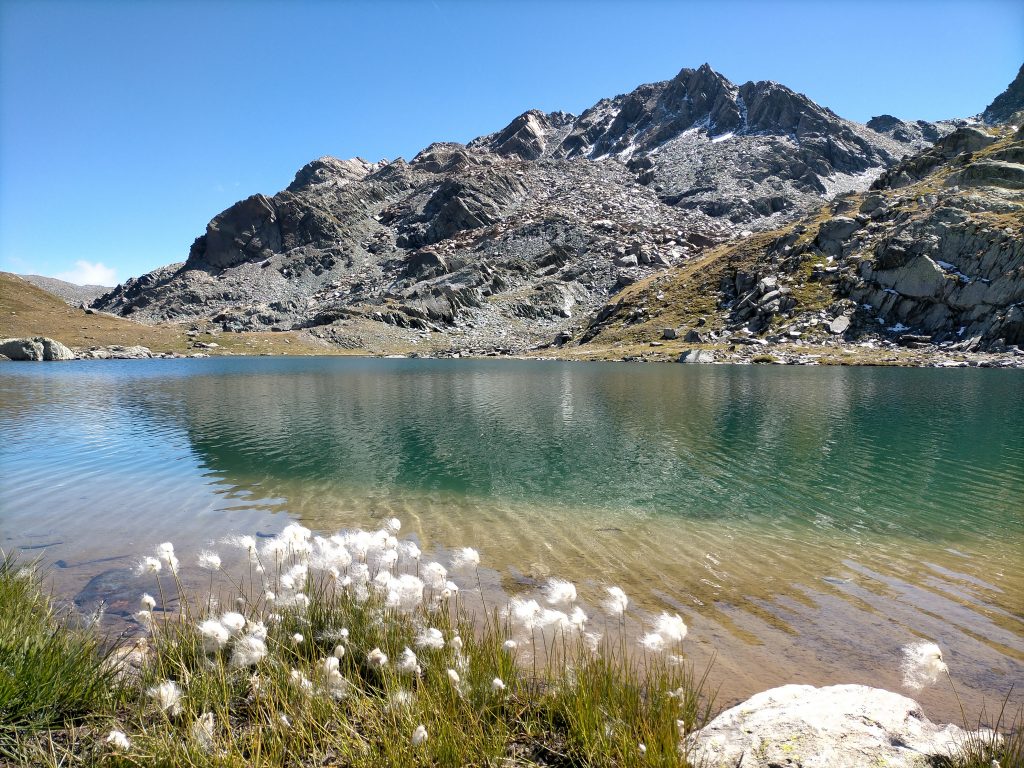
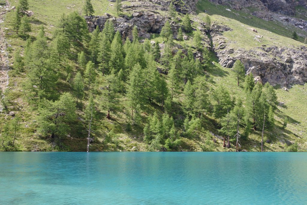
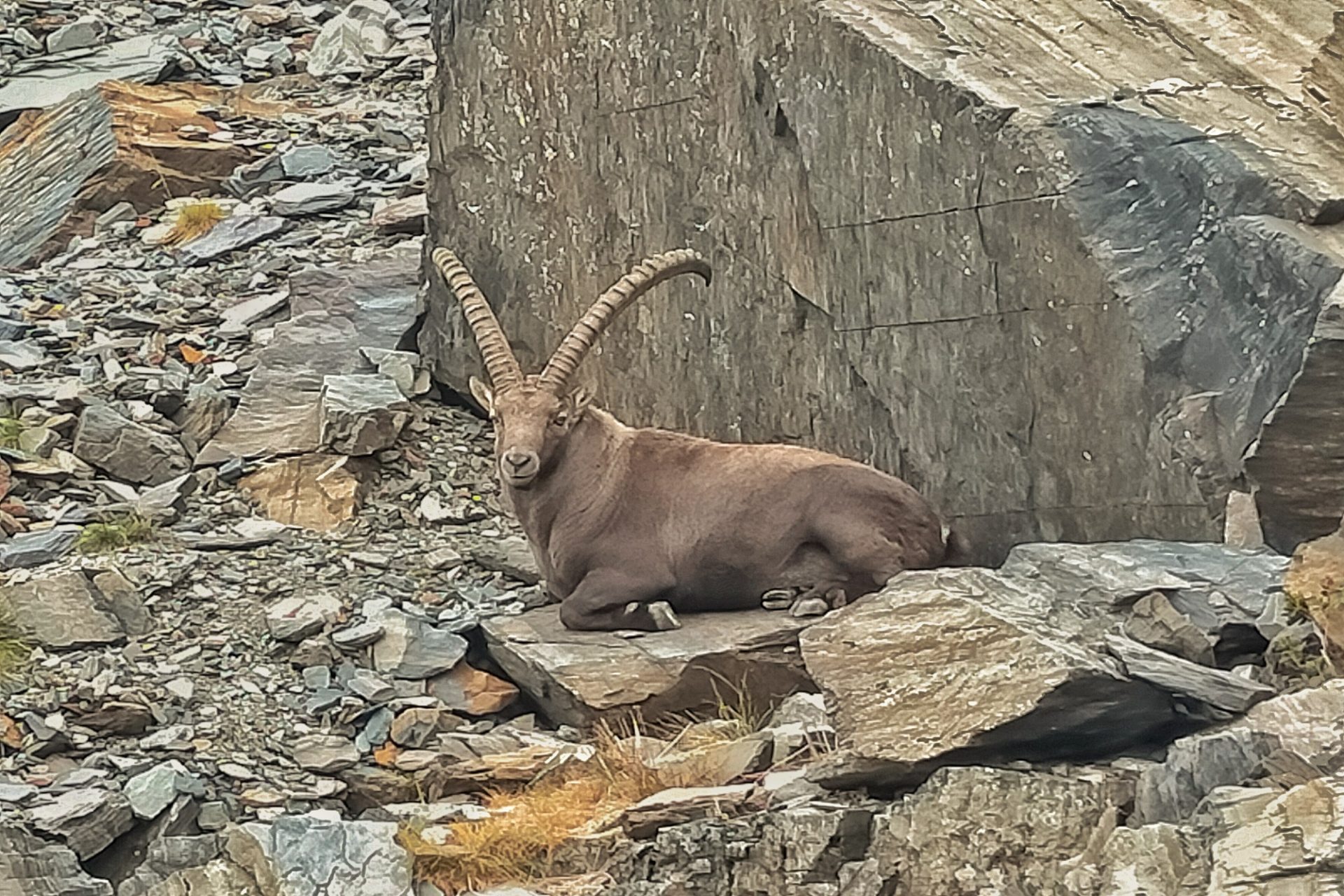
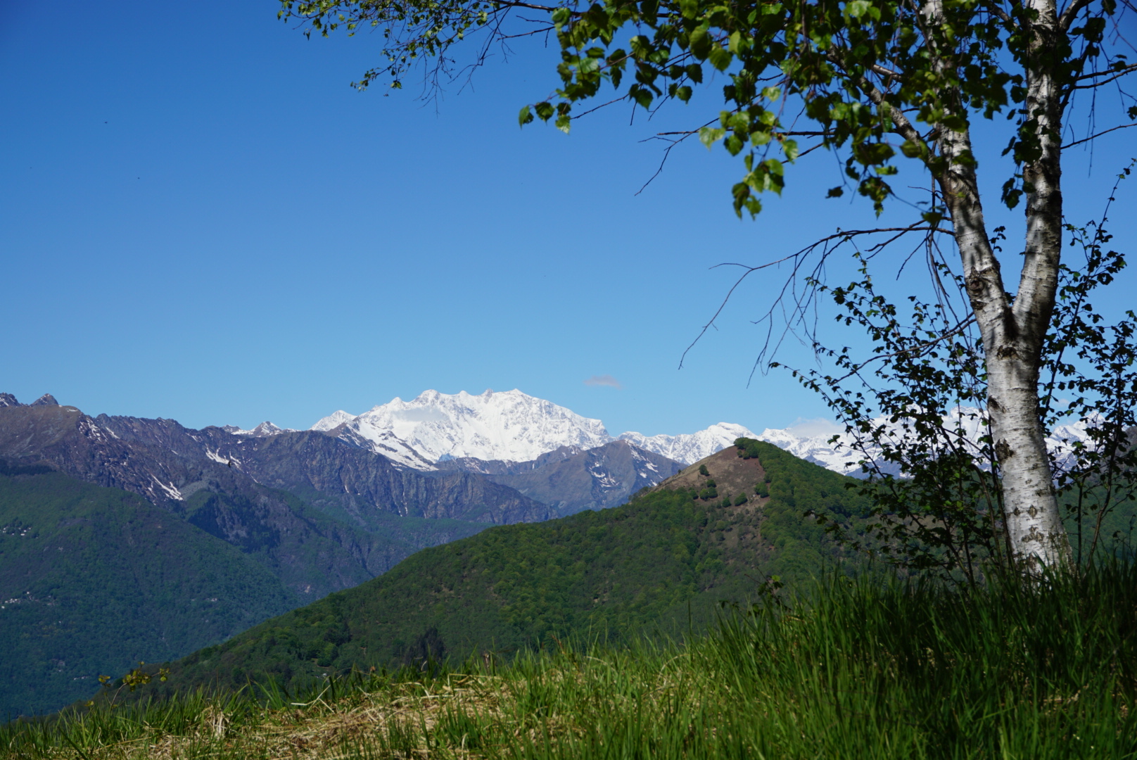
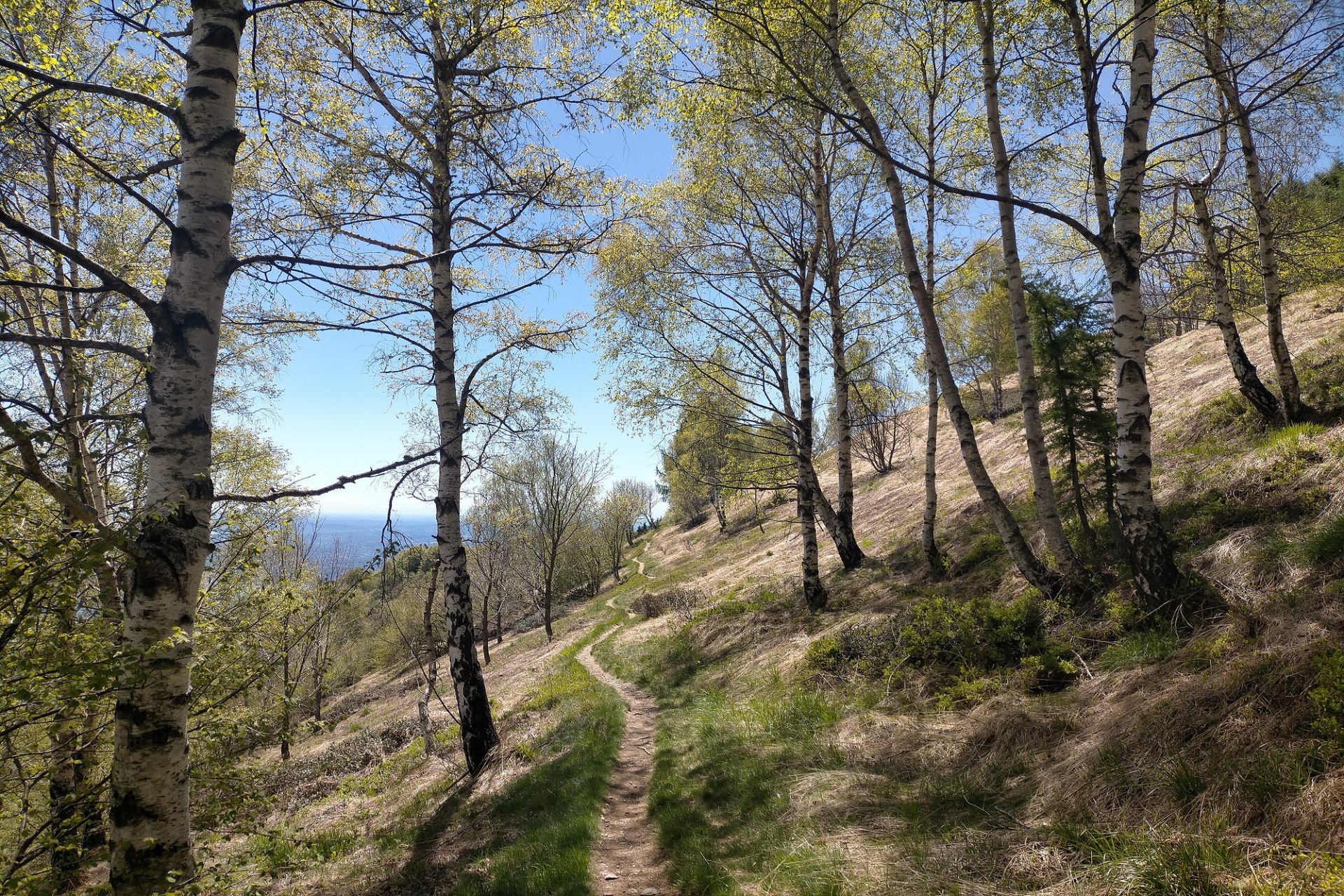
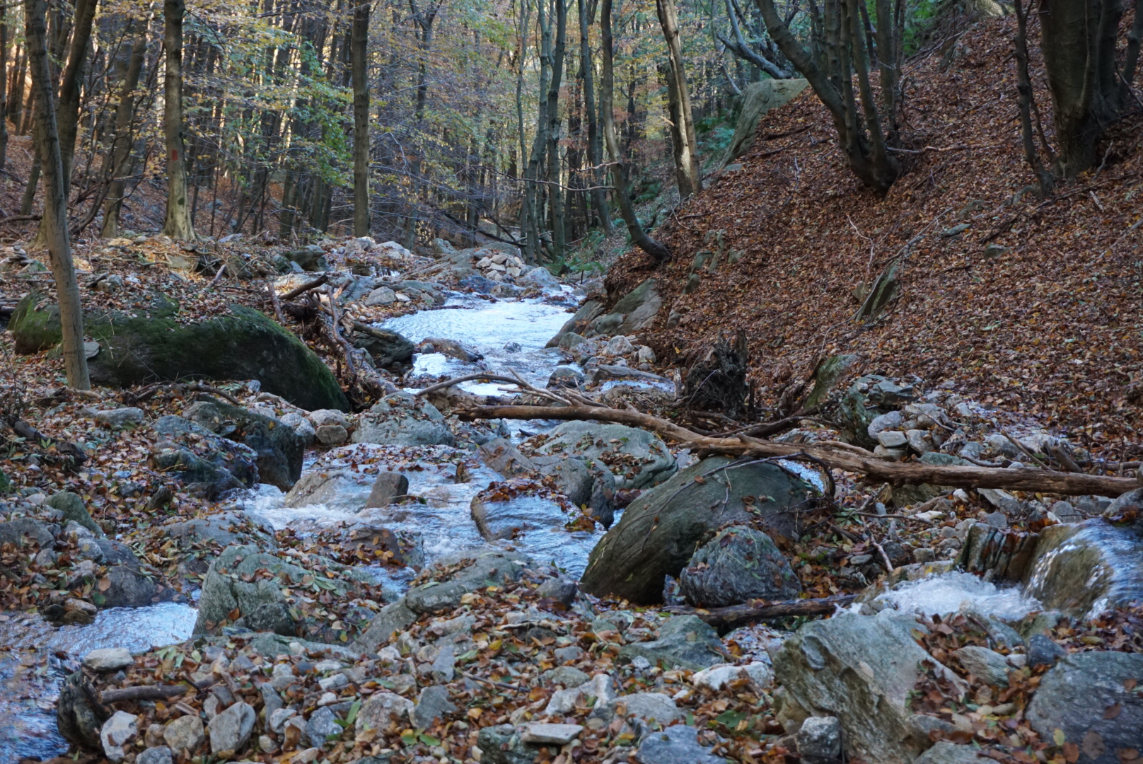
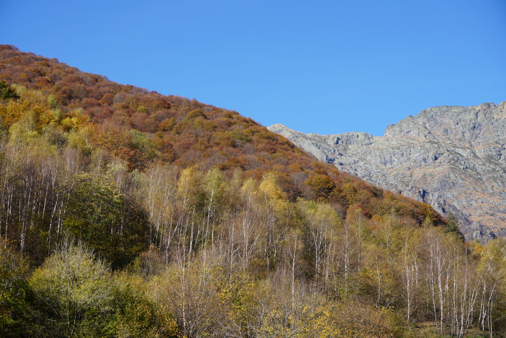
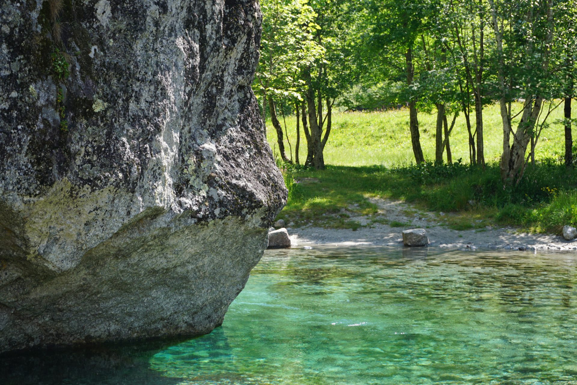
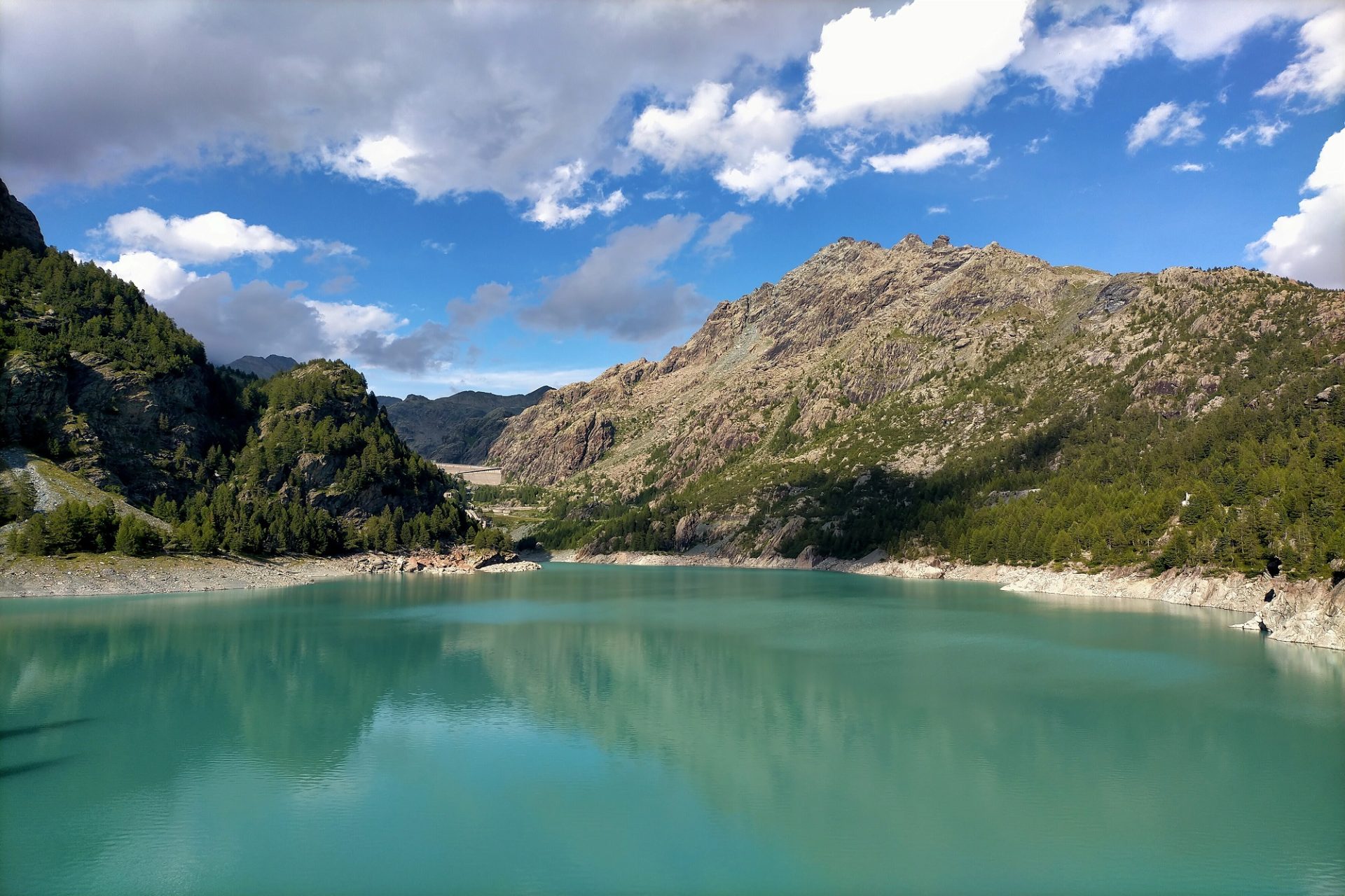
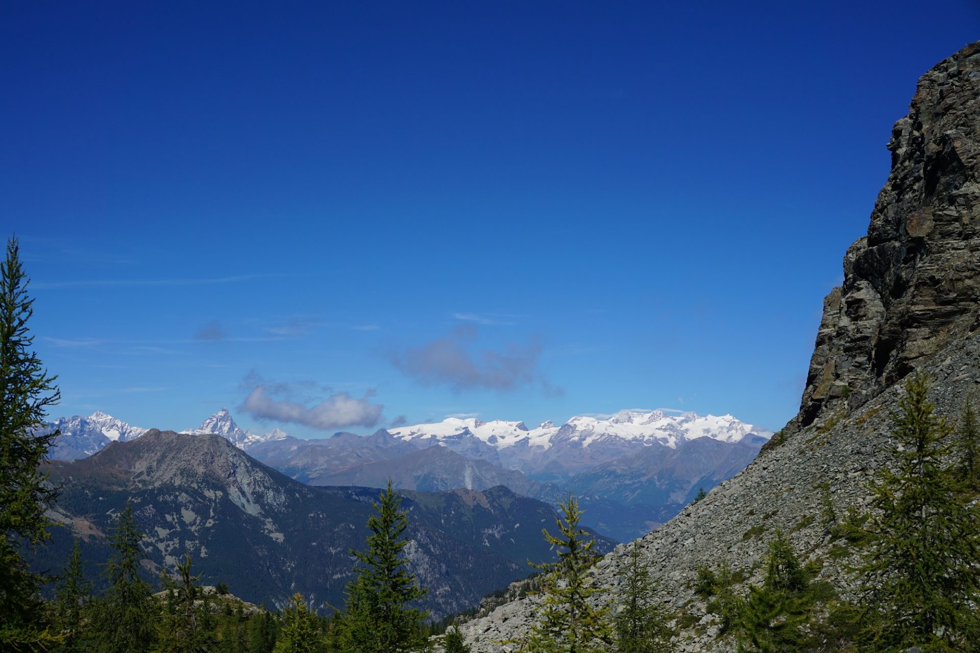
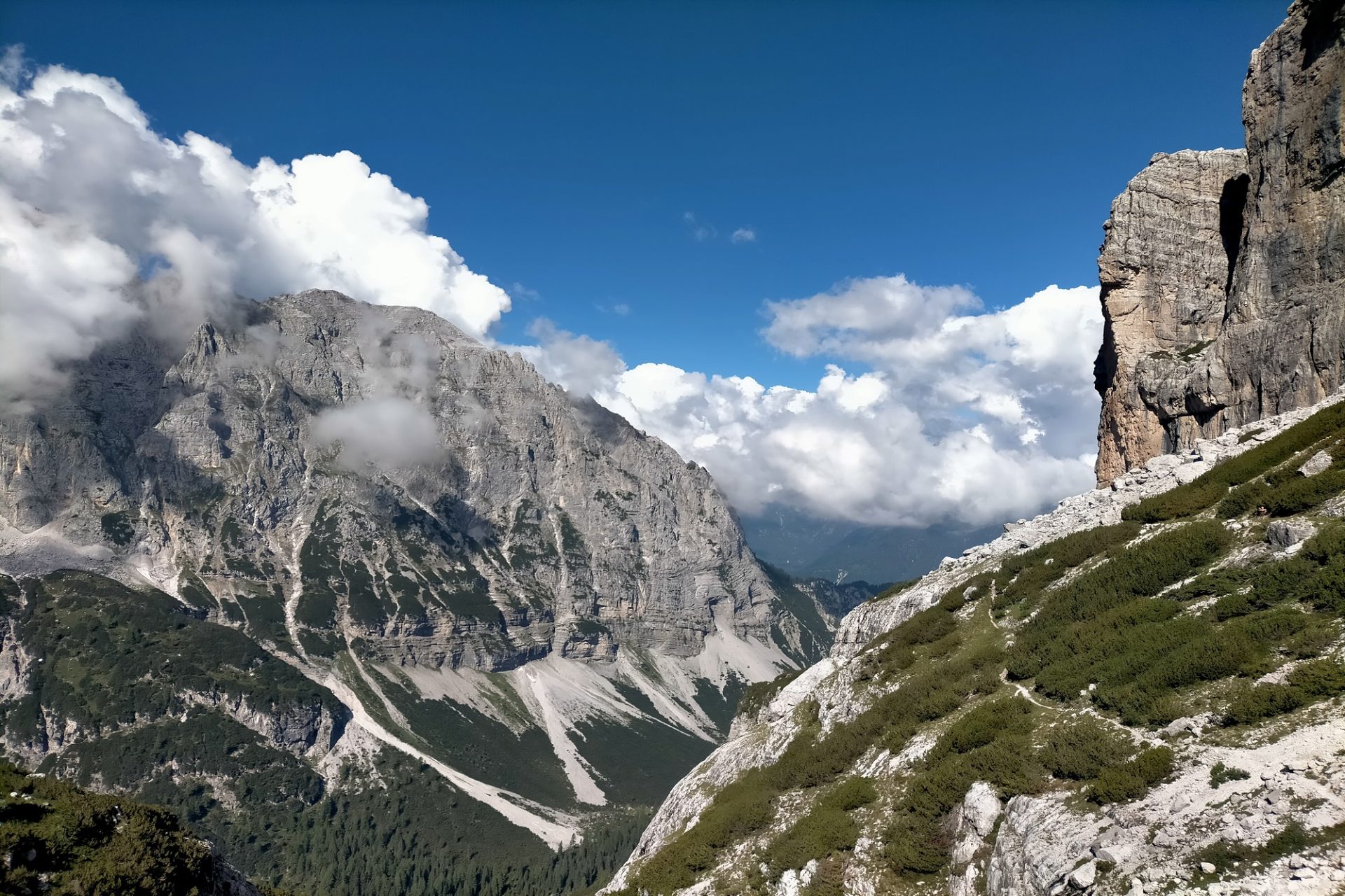
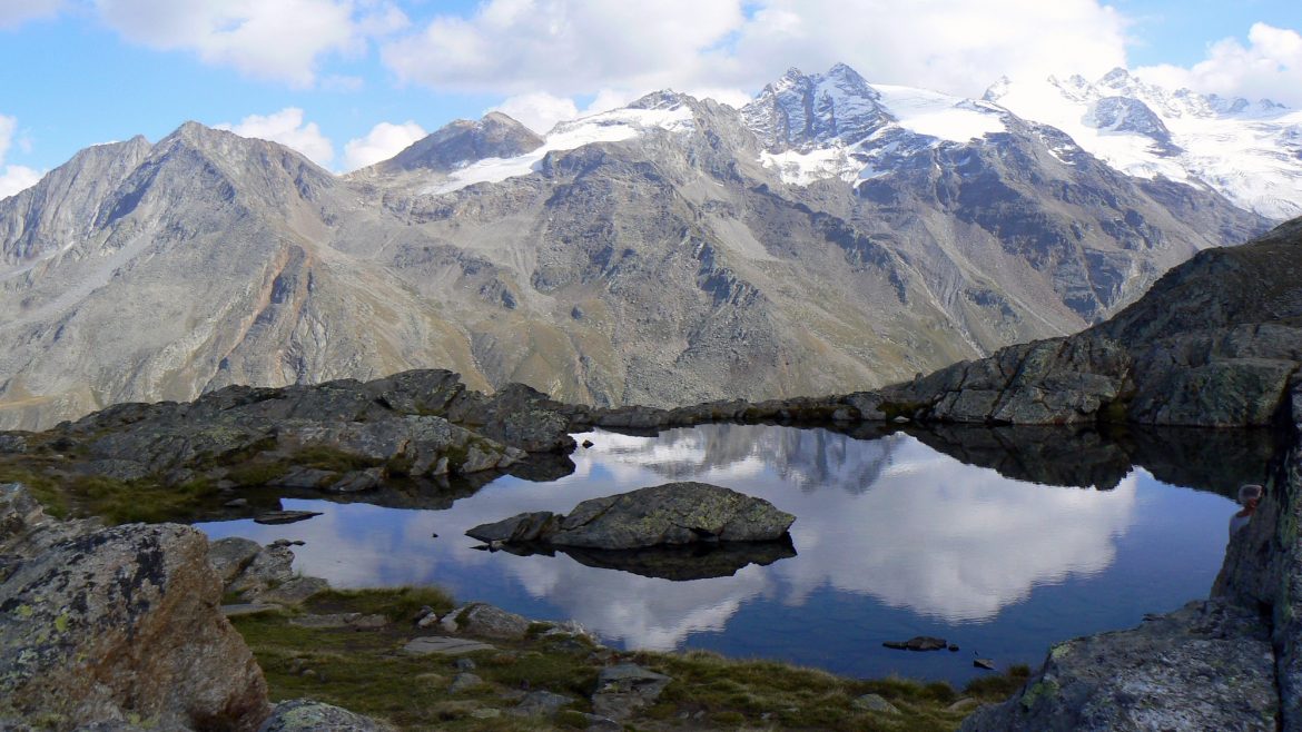
Referred to as one of the best hiking routes in Italy, the Sella-Herbetet traverse grants hikers an authentic and all round experience of the alpine environment. An itinerary that winds from the forest to the high altitude meadows which are a favourite habitat for the animal symbol of the Gran Paradiso National Park, the ibex. A trail that takes us across breathtaking landscapes, near jewel-colored lakes and some of Italy’s highest mountains, including the Gran Paradiso 4.061 m mountain.

Day 1
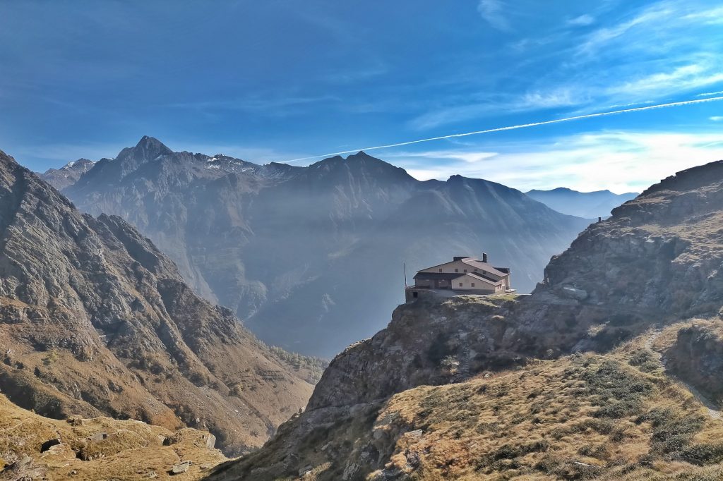
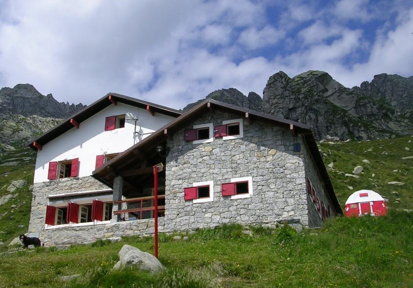
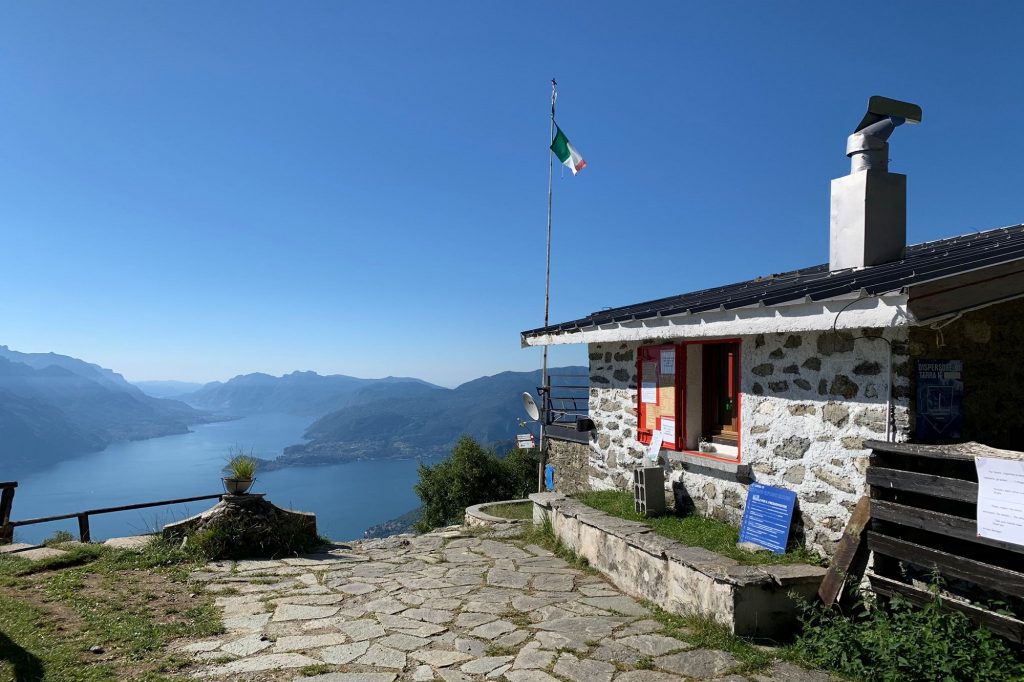
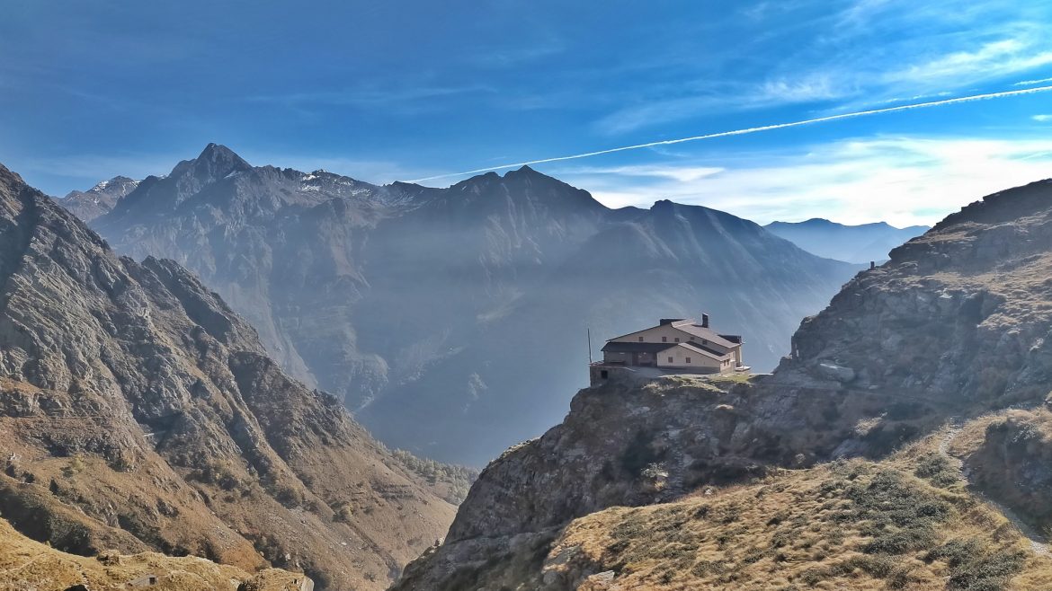
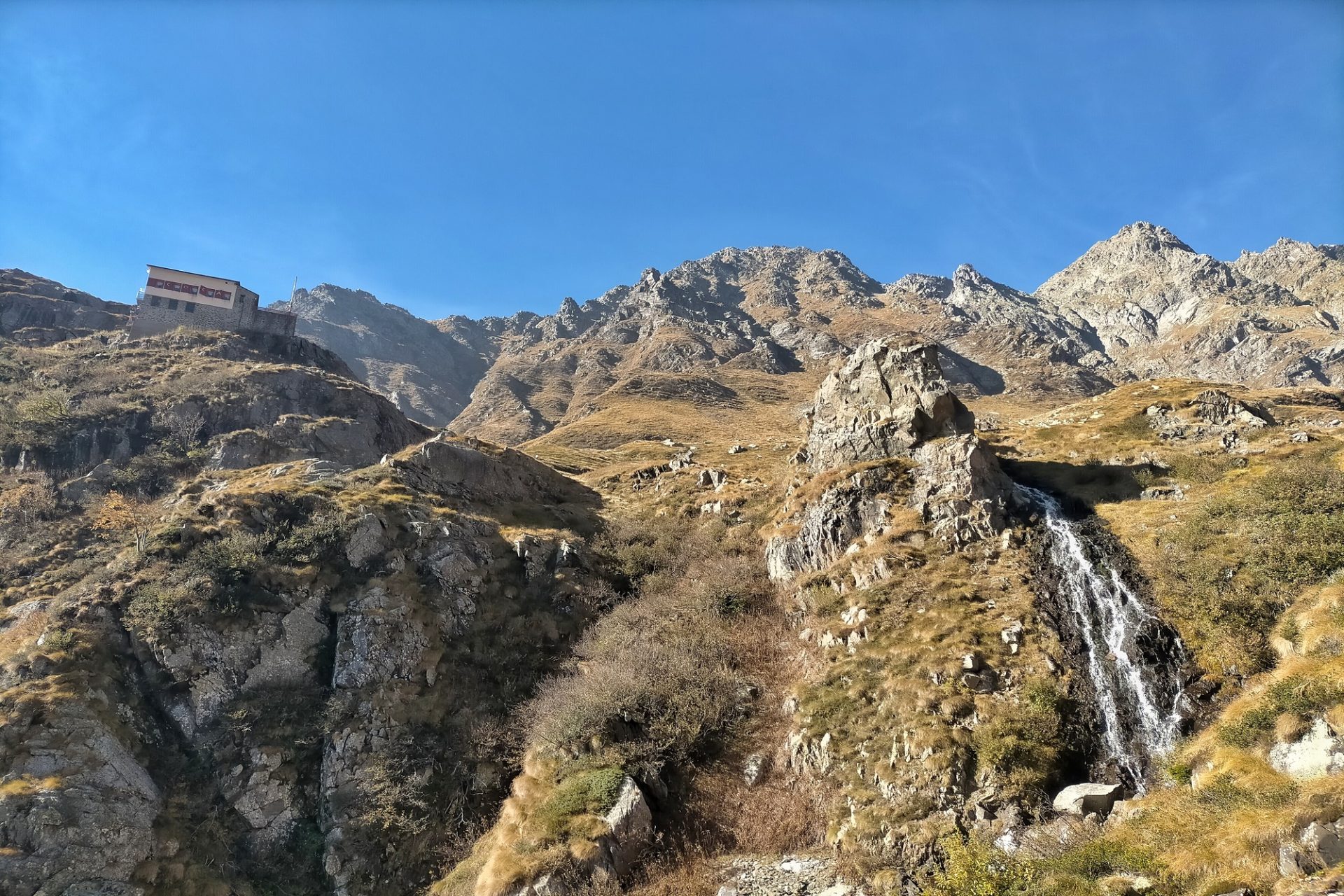
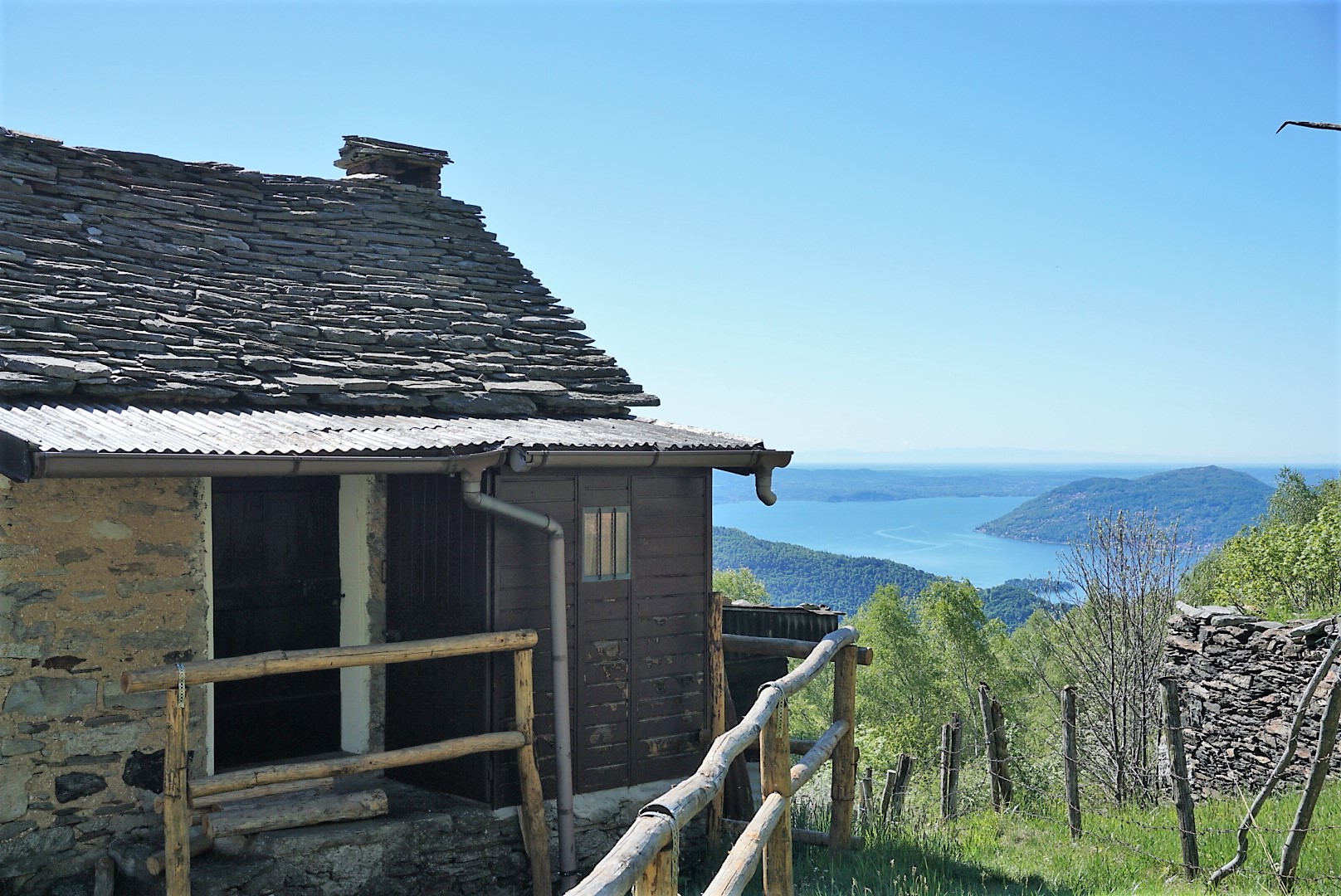
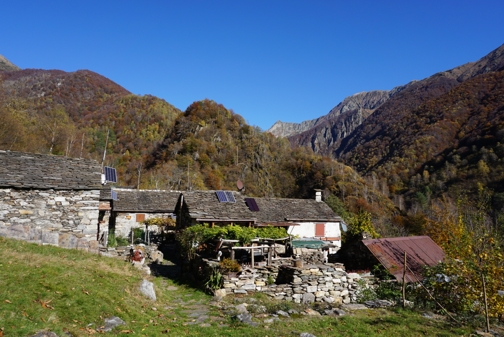
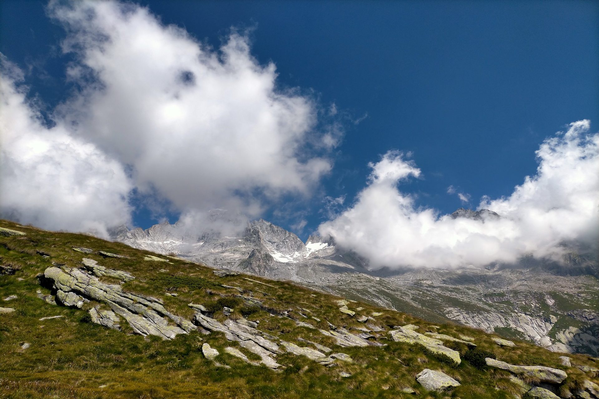
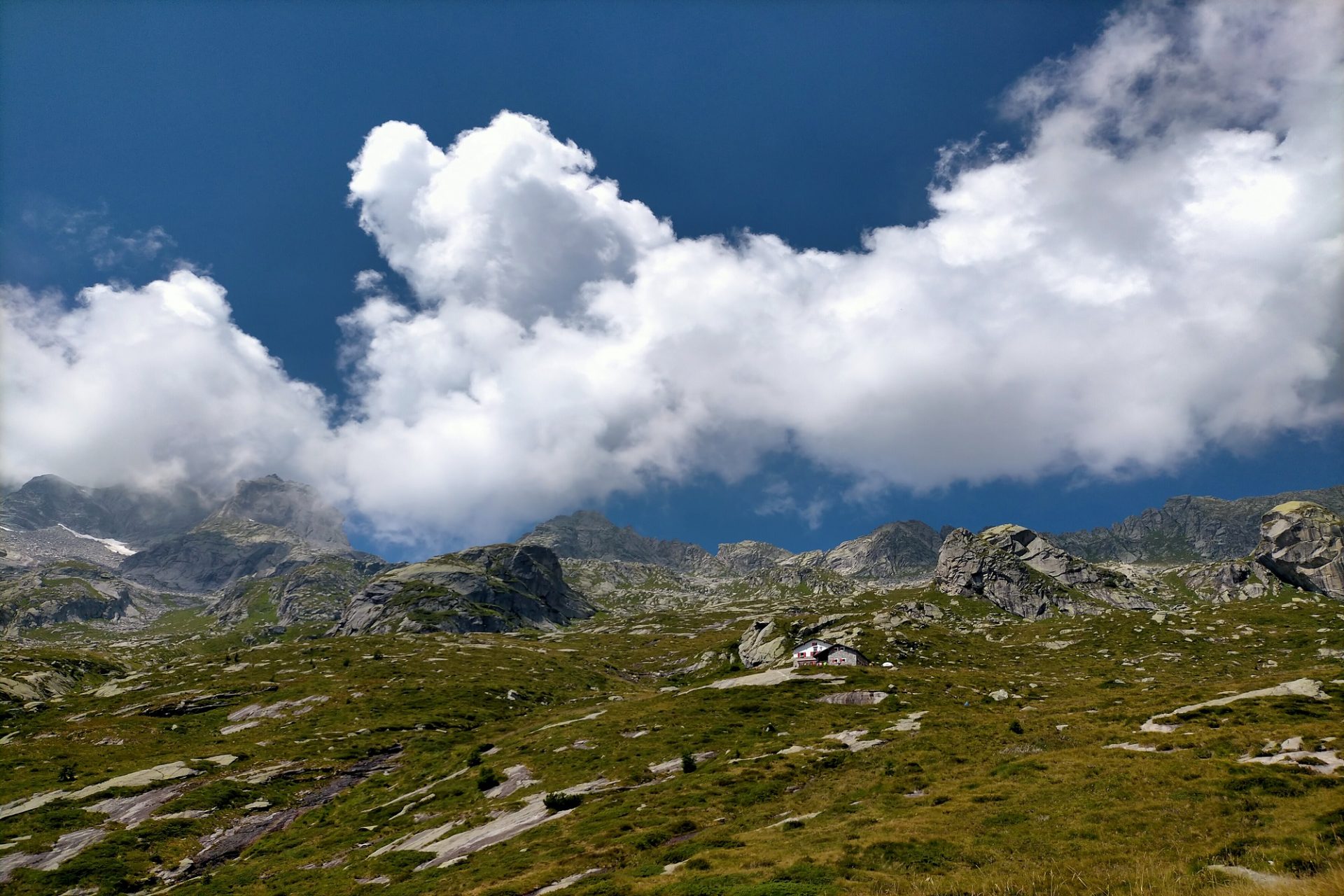
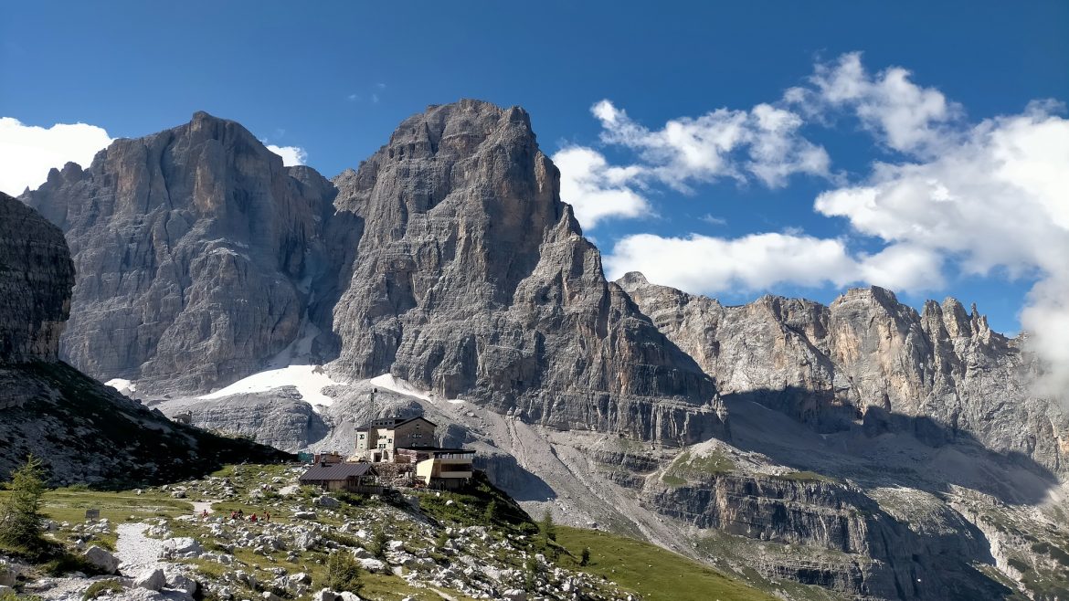
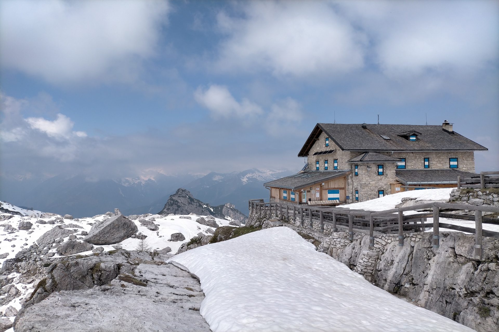
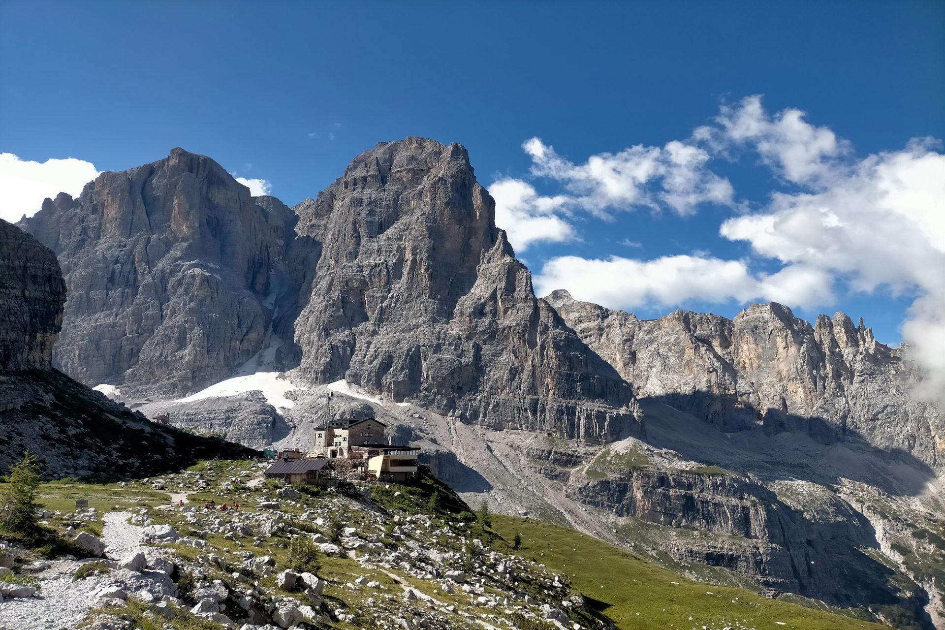
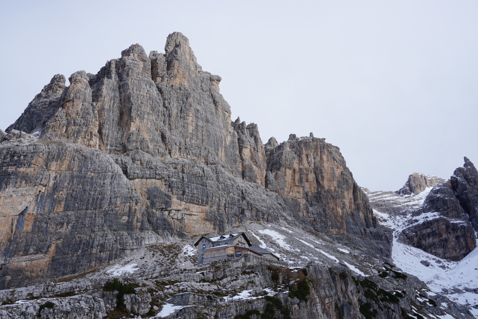
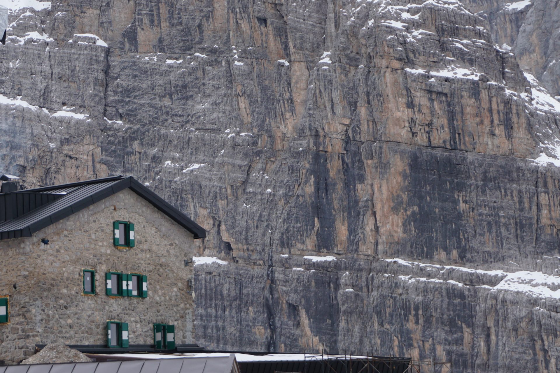
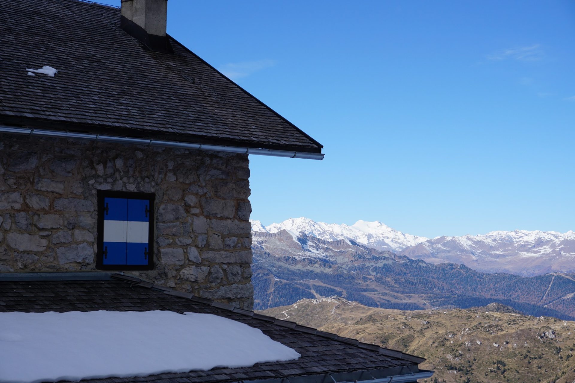
The itinerary starts from the village of Valnontey (1.682 m/5,518 ft), following at first the Alta Via 2 (“Hight Altitude Route Number 2”) to the Sella Hut (2.584 m/8,477 ft), a former hunting lodge of Italy’s first king Vittorio Emanuele II. We start early from the city of Milan and heading to Valnontey (3h). Here we stop exploring the Paradisia Alpine Botanic Garden, home to around 1,000 species of plants and flowers. After lunch in Valnontey we start hiking uphill to the Sella hut (2.5 h) which will be our home for the night. The trail develops along a well-marked mule track and covers most part of the elevation gain of the traverse.

Day 2
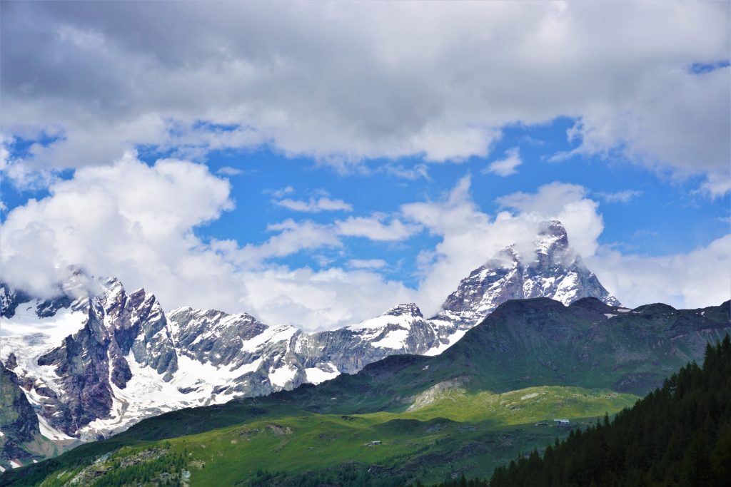
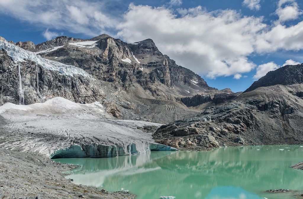
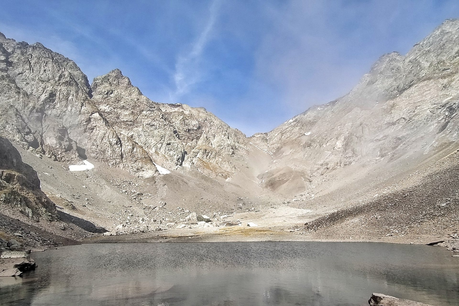
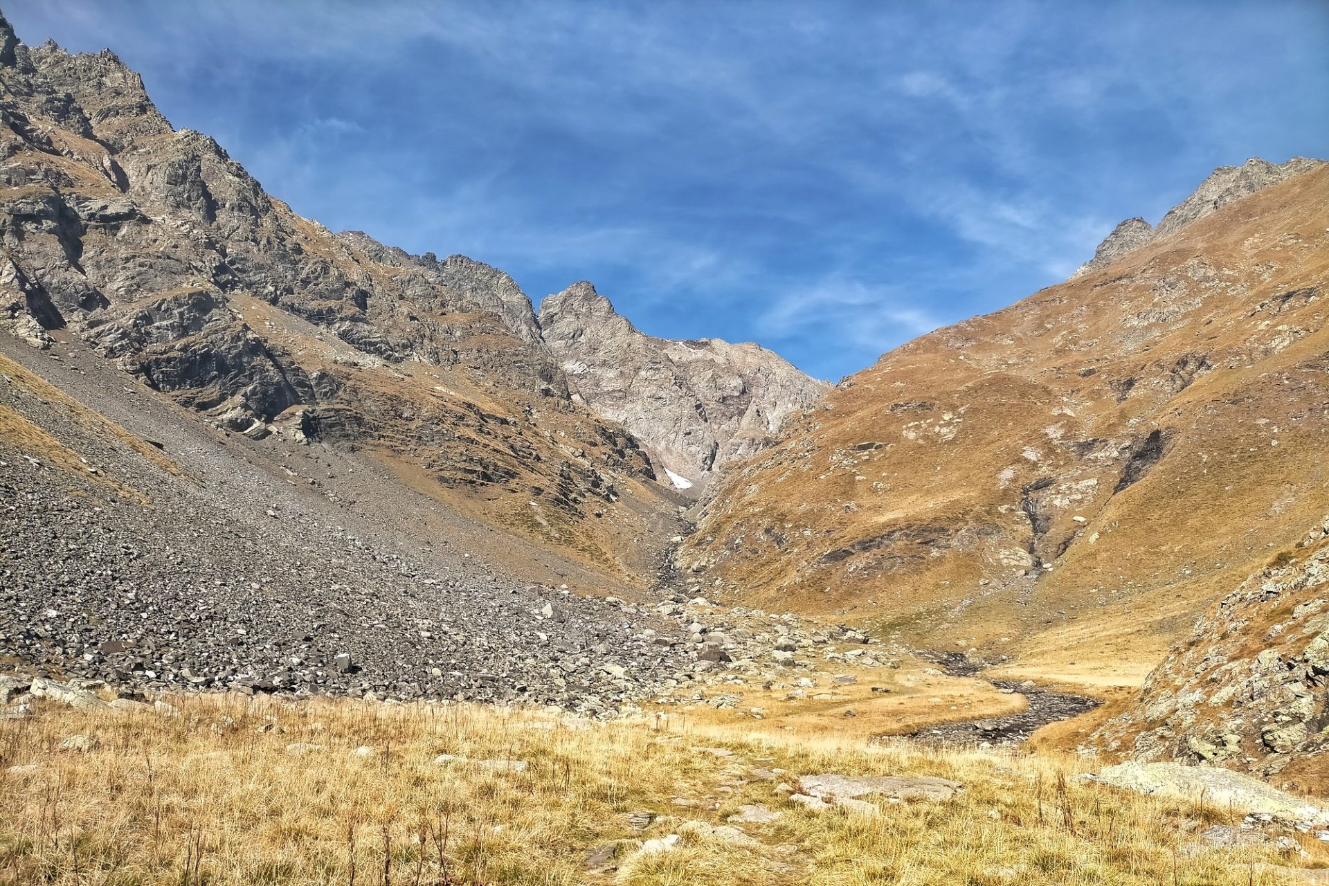
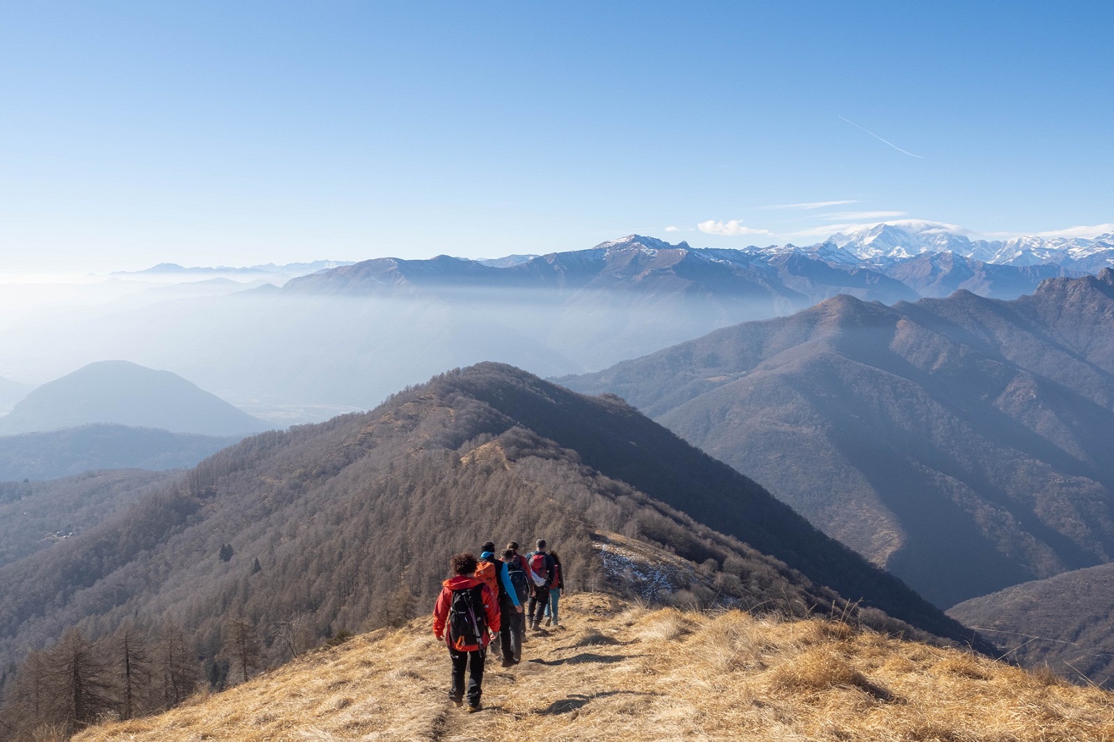
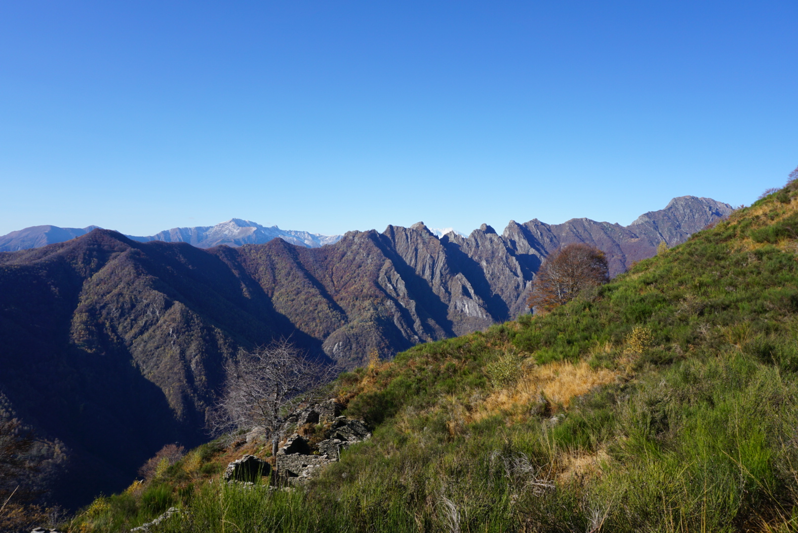
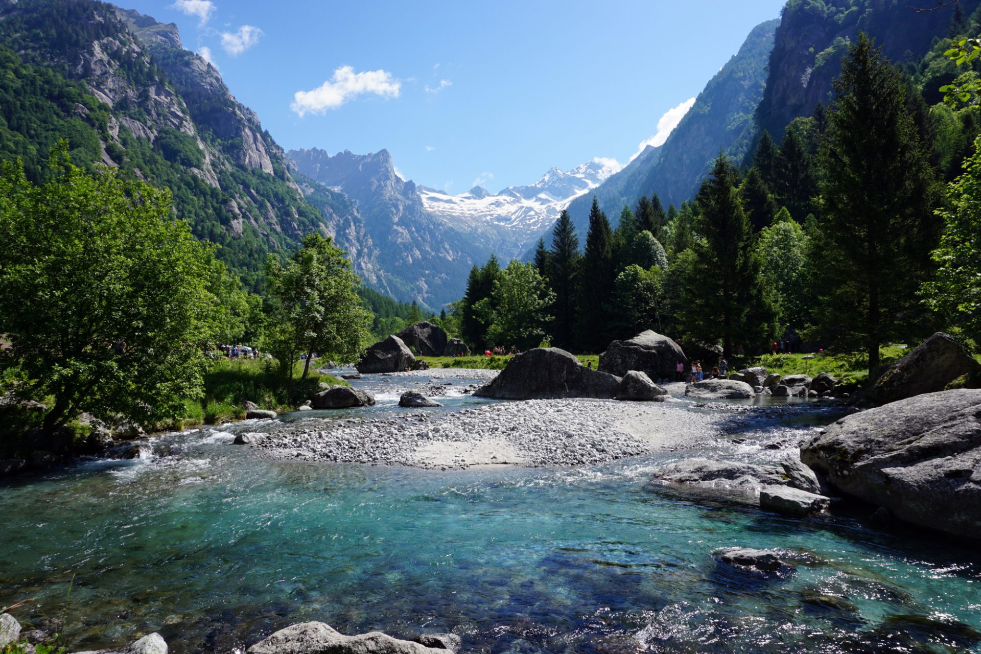
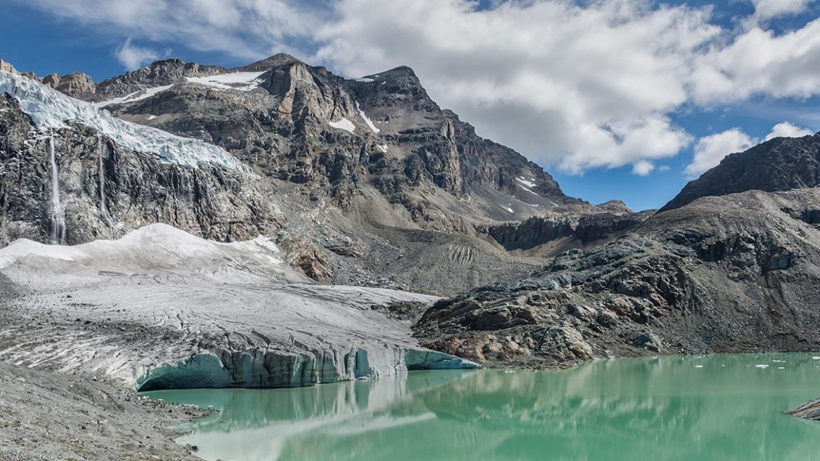
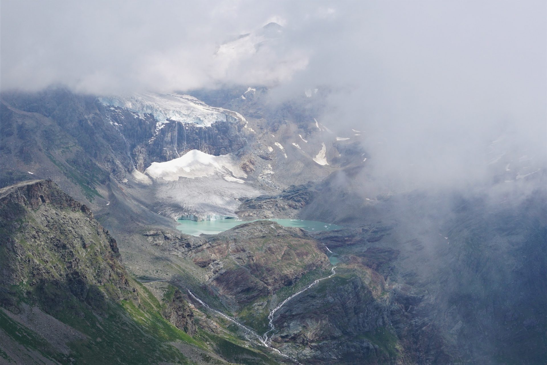
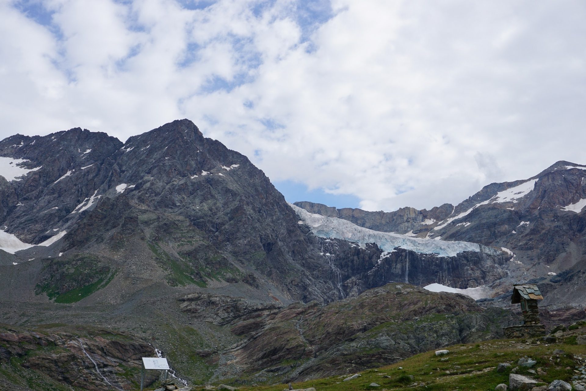
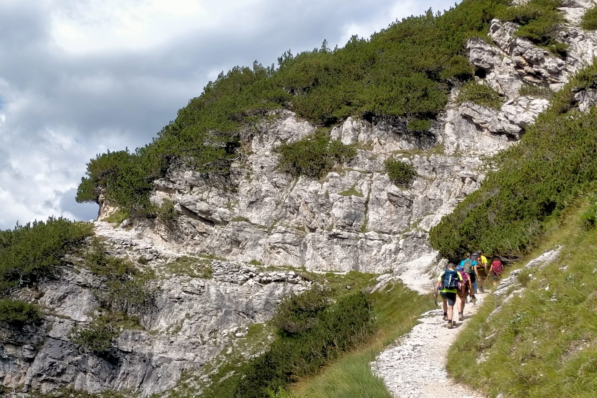
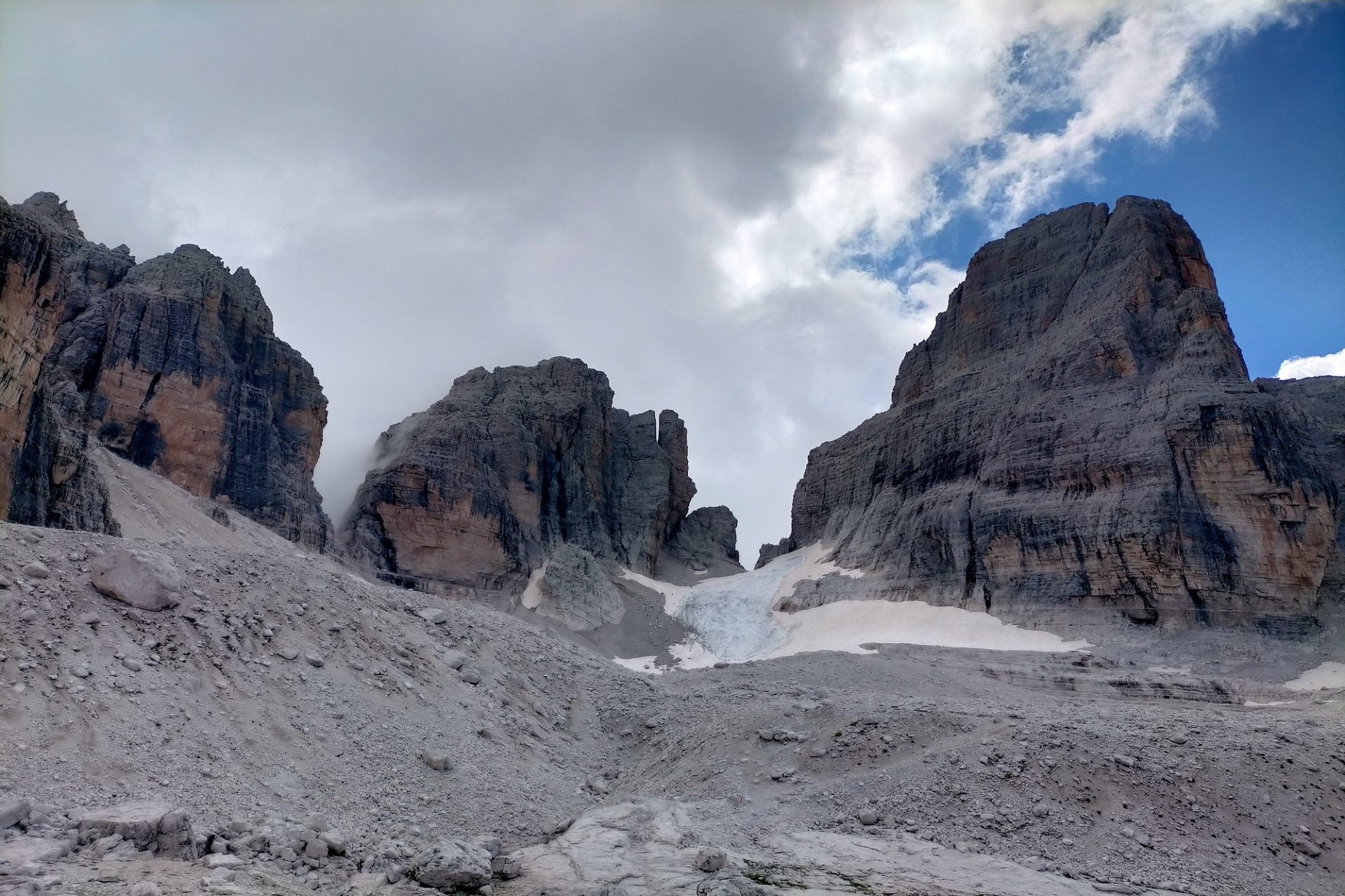
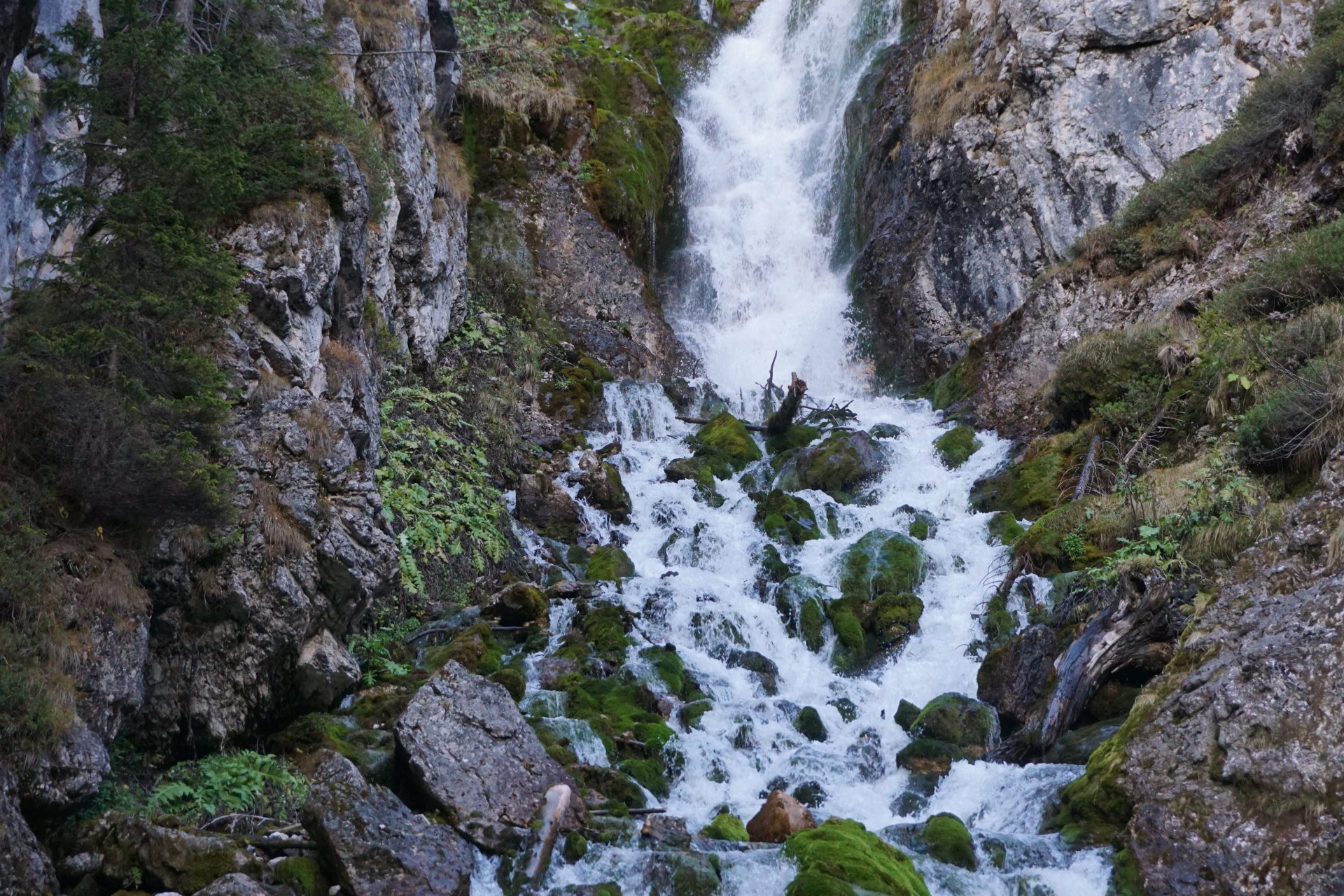
From the hut it’s a long but very panoramic way (most of which downhill) to close our loop itinerary in Valnontey. The path takes us across the western side of the valley, towards the source of the stream that gives the name to Valnontey and the glaciers from which it gets its origin. The views are stunning: peaks of over 3.000 m and the Tribolazione Glacier below the Gran Paradiso itself. A long-distance itinerary not to be taken lightly and that includes some exposed stretches with chains for protection. Participants must have good balance and be confident on their feet.

Experienced hikers with a good training level can cover the itinerary in one day (22 km/13.6 mi), saving money but sacrificing a couple of hours of sleep the night before the hike. Departure from Milan should be scheduled around 5.30am. Contact us for more details.

BEST SEASON: july to september

WHAT TO EXPECT
TRIP TYPE: 
Multi-Day Trek
DRIVING TIME FROM MILAN:
3h – Let us know if you’re staying somewhere else and still want to organize the tour with us. We can meet you on the way!

DAY 1
DIFFICULTY LEVEL: DEMANDING 
– Click HERE to understand the Hiking Difficulty Levels
DISTANCE:
5 km/3.1 mi
ELEVATION GAIN:
  +920 m/3,018 ft
HIGHEST ALTITUDE:
2.588 m/8,490 ft
LUNCH: 
restaurant
OVERNIGHT STAY: mountain hut

DAY 2
DIFFICULTY LEVEL: 
DEMANDING – Click HERE to understand the Hiking Difficulty Levels
DISTANCE:
15 km/9.3 mi
ELEVATION GAIN: +200 m -1.126m/+656 ft -3,694 ft
HIGHEST ALTITUDE:
1.200 m/3,940 ft
LUNCH: 
packed lunch

Private tours are only open to your party
20% discount on the total price for families with kids and parties of 3 and 4. For bigger groups please ask for quote.

GEAR NEEDED: check the list of Things to Bring on a Hut to Hut Multi-day Trek

IMPORTANT: we run our tours in almost all weather conditions and very rarely cancel. See our Terms and Conditions for information on cancellations and refunds

YOU MIGHT ALSO LIKE…

COCA HUT – Day Hike – Level DEMANDING
Located at the foot of the 3.050 metres (10,005 ft) high Coca Peak and surrounded by more mountains of over 3.000 metres, the Coca Hut is a goal for many hikers and one of the most loved in the Orobic Alps. A relentless but highly satisfying climb to reach one of the most panoramic natural [...]
LAKE MAGGIORE – Day Hike – Level MODERATE or DEMANDING
Todum Peak is one of the most panoramic mountains overlooking Lake Maggiore to the south and the Val Grande National Park to the north. A loop itinierary for a 360° view that embraces an area of great beauty, including the gulf of the Borromean Islands and the peaks of the Monte Rosa massif. A car-free [...]
VAL GRANDE NATIONAL PARK – Day Hike – Level DEMANDING
An itinerary that takes you straight to the heart of the Val Grande National Park, the most extensive wilderness of both Italian and European Alps. Thousands of hectares of mountains abandoned by man that nature has been slowly reclaiming over the past fifty years. A treasure to be preserved, that holds the memories of an [...]
MATTERHORN VIEW – Day Hike – Level MODERATE
I’m sure you’ll agree with us in saying that the Matterhorn needs no introductions. With its 4,478 metres and a pyramid-perfect shape, the Mattherhorn is with good reason one of the most beautiful mountains in the entire world and the most photographed peak located on the border between Italy and Switzerland. The Matterhorn (referred to [...]
VAL MASINO EXPLORE – 2 Days Trek – Level DEMANDING
Located in the very central part of the Italian Alps and framed by those high mountains that divide it from Switzerland, Val Masino is, with good reason, one of the most beautiful italian valleys. The "land of granite"- as everybody calls it - is a paradise for rock climbers but also for those enthusiastic hikers [...]
FELLARIA GLACIER – Day Hike – Level DEMANDING
Have you ever seen a glacier from a very close distance? The bad news is that there are not many of them left on the planet and that unfortunatelly due to global warming they're all melting pretty fast. The good news is that one of them is only a couple of hours away from Milan! [...]
BARBUSTEL HUT AND LAKES – Day Hike – Level MODERATE or DEMANDING
Immersed in the pristine nature of Mont Avic Natural Park, Barbustel Hut serves as a base for exploring the infinite collection of alpine lakes in the surrounding areas. White Lake, Black Lake, Big Lake and so on, all different from one another and all picture perfect! From here, in a distance, we can enjoy wonderful [...]
WAYFARER’S PATH – Day Hike – Level EASY, MODERATE or DEMANDING
Half-way up the hills on the Eastern side of Lake Como, a series of ancient cobblestone paths and mule trails connect charming little shoreline villages to the higher altitude pristine meadows. Where they merge, a longer trail begins known today as the Wayfarer’s Path (“Sentiero del Viandante” in Italian). Over the centuries, this well traveled [...]
MENAGGIO HUT – Day Hike – Level MODERATE
A panoramic excursion over the northern branch of Lake Como and one that offers spectacular views of the Bellagio pensinsula and the lake's southern branches. Starting from the fir forest just above the village of Menaggio we reach first the little mountain chapel of Sant'Amate, located at an altitude of 1.623m (5,320 ft) above the [...]
BLUE LAKE – Day Hike – Level MODERATE
Located at the feet of the Monte Rosa Massif, the Blue Lake is one of the most popular hiking destionations in the Ayas Valley. It is an alpine lake of pristine turquoise water that originates from the ice melting of the Verra Grand Glacier. The landscape all around is simply stunning. From the fir and [...]
trek-mi-orobian-alps-hiking-coca-hut

COCA HUT – Day Hike – Level DEMANDING

COCA HUT – Day Hike – Level DEMANDING 2000 1333 TrekMI

Located at the foot of the 3.050 metres (10,005 ft) high Coca Peak and surrounded by more mountains of over 3.000 metres, the Coca Hut is a goal for many hikers and one of the most loved in the Orobic Alps. A relentless but highly satisfying climb to reach one of the most panoramic natural terraces in the area. Nestled on a rocky outcrop overlooking the valley below, the Coca Hut offers stunning views and a well deserved retreat. Also it serves as a base for many mountaineering climbs and high-altitude multi-day treks. From here, adding an extra 200 metres (656 ft) smooth climb, it possible to reach Lake Coca, set in a suggestive glacial basin surrounded.

BEST SEASON: end of june to end of september

WHAT TO EXPECT
TRIP TYPE:
Day Hike Tour
TRIP LENGTH: 
Full Day
DRIVING TIME FROM MILAN:
2 hours – Let us know if you’re staying somewhere else and still want to organize the tour with us. We can meet you on the way!


DIFFICULTY LEVEL: DEMANDING
– Click HERE to understand the Hiking Difficulty Levels


DISTANCE:
6,5 km/4 mi
ELEVATION GAIN:
  958 m/3,143 ft
HIGHEST ALTITUDE:
1.891 m/6,204 ft
LUNCH: 
mountain hut

Private tours are only open to your party
20% discount on the total price for families with kids and parties of 3 and 4. For bigger groups please ask for quote.

GEAR NEEDED: check the list of Things to Bring on a Day Hike

IMPORTANT: we run our tours in almost all weather conditions and very rarely cancel. See our Terms and Conditions for information on cancellations and refunds

YOU MIGHT ALSO LIKE…

trek-mi-lake-maggiore- Monte-Todum

LAKE MAGGIORE – Day Hike – Level MODERATE or DEMANDING

LAKE MAGGIORE – Day Hike – Level MODERATE or DEMANDING 1616 1080 TrekMI

Todum Peak is one of the most panoramic mountains overlooking Lake Maggiore to the south and the Val Grande National Park to the north. A loop itinierary for a 360° view that embraces an area of great beauty, including the gulf of the Borromean Islands and the peaks of the Monte Rosa massif. A car-free traditional rural village of great charm, an enchanting birch forest and some isolated mountain pastures are also waiting to be discovered on the way to the peak. As part of the ridge that looks right into the Val Grande National Park, Mount Todum is the perfect spot for a focus on interesting historical facts and curiosities concerning this area. The hike can be extended of an extra +200m (656 ft) to make it to the top of Piz Pernice (1.506 m /4,940 ft) along an extremely panoramic ridge trail.

BEST SEASON: may to october

WHAT TO EXPECT
TRIP TYPE:
Day Hike Tour
TRIP LENGTH: 
Full Day
DRIVING TIME FROM MILAN:
1h45 – Let us know if you’re staying somewhere else and still want to organize the tour with us. We can meet you on the way!


– DIFFICULTY LEVEL: MODERATE
– Click HERE to understand the Hiking Difficulty Levels
DISTANCE:
9 km/5.6 mi
ELEVATION GAIN:
  720 m/2,362 ft
HIGHEST ALTITUDE:
1.298 m/4,258 ft
LUNCH: 
bring your own packed lunch

– DIFFICULTY LEVEL: DEMANDING – Click HERE to understand the Hiking Difficulty Levels
DISTANCE: 11 km/6.8 mi
ELEVATION GAIN:  930 m/3,051 ft
HIGHEST ALTITUDE: 1.506 m/4,940 ft
LUNCH: bring your own packed lunch

Private tours are only open to your party
20% discount on the total price for families with kids and parties of 3 and 4. For bigger groups please ask for quote.

GEAR NEEDED: check the list of Things to Bring on a Day Hike

IMPORTANT: we run our tours in almost all weather conditions and very rarely cancel. See our Terms and Conditions for information on cancellations and refunds

YOU MIGHT ALSO LIKE…

trek-mi-val-grande-national-park

VAL GRANDE NATIONAL PARK – Day Hike – Level DEMANDING

VAL GRANDE NATIONAL PARK – Day Hike – Level DEMANDING 2560 1920 TrekMI

An itinerary that takes you straight to the heart of the Val Grande National Park, the most extensive wilderness of both Italian and European Alps. Thousands of hectares of mountains abandoned by man that nature has been slowly reclaiming over the past fifty years. A treasure to be preserved, that holds the memories of an ancient world and remnants of the hard-working people who lived there nearly secluded until the last century. The area was also ground to some tragic events that took place during the II World War. Starting from the village of Cicogna (reached along an adventurous narrow road) we hike up to the panoramic terrace of Alpe Prà, enjoying wonderful views over Lake Maggiore. The trail takes us then in the beech forest to the ruins of Alpe Leciuri, our highest point for the day. From here we start descending towards Pogallo, once the biggest village along the transhumance routes to the higher pastures. From Pogallo we then get back to Cicogna along the scenic muletrack that stretches right in the gorge of the river, that here forms crystal clear pools and waterfalls. This itinerary is particularly recommended during fall.

BEST SEASON: may to october, avoiding the hottest months of july and august

WHAT TO EXPECT
TRIP TYPE:
Day Hike Tour
TRIP LENGTH: 
Full Day
DRIVING TIME FROM MILAN:
1h45 – Let us know if you’re staying somewhere else and still want to organize the tour with us. We can meet you on the way!


DIFFICULTY LEVEL: DEMANDING
– Click HERE to understand the Hiking Difficulty Levels


DISTANCE:
10 km/6.2 mi
ELEVATION GAIN:
  750 m/2,460 ft
HIGHEST ALTITUDE:
1.311 m/4,301 ft
LUNCH: 
bring your own packed lunch

Private tours are only open to your party
20% discount on the total price for families with kids and parties of 3 and 4. For bigger groups please ask for quote.

GEAR NEEDED: check the list of Things to Bring on a Day Hike

IMPORTANT: we run our tours in almost all weather conditions and very rarely cancel. See our Terms and Conditions for information on cancellations and refunds

YOU MIGHT ALSO LIKE…

trek-mi-rhaetian-alps-hiking-omio-hut

VAL MASINO EXPLORE – 2 Days Trek – Level DEMANDING

VAL MASINO EXPLORE – 2 Days Trek – Level DEMANDING 846 590 TrekMI

Located in the very central part of the Italian Alps and framed by those high mountains that divide it from Switzerland, Val Masino is, with good reason, one of the most beautiful italian valleys. The “land of granite”- as everybody calls it – is a paradise for rock climbers but also for those enthusiastic hikers who are willing to get closer to some over 3,000 metres high peak. In two days we’ll have a chance to explore its most beautiful corners, including the “Golden Valley” (Valle dell’Oro) and Little Yosemite (Val di Mello).

Day 1
We hike to the Omio Hut which will be our home for the night. Built on the edge of a panoramic bastion that overlooks the Masino Valley, the Omio Hut is a spectacular observation point of the highest mountains in the area.

Day 2
After descending from the Omio Hut and back to the car, we reach the Mello Valley, Val di Mello gets its namesake (Italian Little Yosemite) for features resembling some of the majestic formations found in California’s Yosemite Valley: imposing walls and domes of polished granite rock modelled by glaciation, streams, pools and waterfalls of crystal-clear icy water. A scenic background for the valley’s lush mountain meadows of exceptional natural beauty!

BEST SEASON: end of june to october

WHAT TO EXPECT
TRIP TYPE: 
Multi-Day Trek
TRIP LENGTH: 
2 Full Days
DRIVING TIME FROM MILAN:
2h15 – Let us know if you’re staying somewhere else and still want to organize the tour with us. We can meet you on the way!

DAY 1
DIFFICULTY LEVEL: DEMANDING 
– Click HERE to understand the Hiking Difficulty Levels
DISTANCE:
4,5 km/2.7 mi
ELEVATION GAIN:
  +950 m/3,116 ft
HIGHEST ALTITUDE:
2.104 m/6,902 ft
LUNCH: 
restaurant
OVERNIGHT STAY: mountain hut

DAY 2
DIFFICULTY LEVEL: 
DEMANDING – Click HERE to understand the Hiking Difficulty Levels
DISTANCE:
15 km/9.3 mi
ELEVATION GAIN: +300 m -1.250m/+984 ft -4,100 ft
HIGHEST ALTITUDE:
1.200 m/3,940 ft
LUNCH: 
mountain hut

Private tours are only open to your party
20% discount on the total price for families with kids and parties of 3 and 4. For bigger groups please ask for quote.

GEAR NEEDED: check the list of Things to Bring on a Hut to Hut Multi-day Trek

IMPORTANT: we run our tours in almost all weather conditions and very rarely cancel. See our Terms and Conditions for information on cancellations and refunds

YOU MIGHT ALSO LIKE…

trek-mi-rhaetian-alps-hiking-fellaria-glacier

FELLARIA GLACIER – Day Hike – Level DEMANDING

FELLARIA GLACIER – Day Hike – Level DEMANDING 1212 796 TrekMI

Have you ever seen a glacier from a very close distance? The bad news is that there are not many of them left on the planet and that unfortunatelly due to global warming they’re all melting pretty fast. The good news is that one of them is only a couple of hours away from Milan! The Fellaria Glacier, one of the biggest glaciers in the Central Alps, can be reached with a demanding level hike, suitable for reasonably fit and enthusiastic hikers. The last part off the trail develops on uneven terrain such as glacial debris. A great opportunity to walk across an extremely fascinating territory shaped by the ice during centuries. The Fellaria Glacier has become a model of study for glaciologists and a very popular hiking destination during summer months. Don’t wait longer!

BEST SEASON: end of june to end of september

WHAT TO EXPECT
TRIP TYPE:
Day Hike Tour
TRIP LENGTH: 
Full Day
DRIVING TIME FROM MILAN:
2.5 hours – Let us know if you’re staying somewhere else and still want to organize the tour with us. We can meet you on the way!


DIFFICULTY LEVEL: DEMANDING
– Click HERE to understand the Hiking Difficulty Levels


DISTANCE:
16 km/10 mi
ELEVATION GAIN:
  730 m/2,395 ft
HIGHEST ALTITUDE:
2.604 m/8,543 ft
LUNCH: 
bring your own packed lunch

Private tours are only open to your party
20% discount on the total price for families with kids and parties of 3 and 4. For bigger groups please ask for quote.

GEAR NEEDED: check the list of Things to Bring on a Day Hike

IMPORTANT: we run our tours in almost all weather conditions and very rarely cancel. See our Terms and Conditions for information on cancellations and refunds

YOU MIGHT ALSO LIKE…

trek-mi-aosta-valley-barbustel-hut-lakes

BARBUSTEL HUT AND LAKES – Day Hike – Level MODERATE or DEMANDING

BARBUSTEL HUT AND LAKES – Day Hike – Level MODERATE or DEMANDING 2560 1920 TrekMI

Immersed in the pristine nature of Mont Avic Natural Park, Barbustel Hut serves as a base for exploring the infinite collection of alpine lakes in the surrounding areas. White Lake, Black Lake, Big Lake and so on, all different from one another and all picture perfect! From here, in a distance, we can enjoy wonderful views of the higher snow-capped mountains, including Matterhorn, the Monte Rosa Massif and Dent d’Herens, all of them on the border with Switzerland. The hike towards Barbustel Hut is Level Medium, suitable for people who have a basic fitness level. If you want more challenge and see more lakes we can hike higher. In that case it becomes Level Demanding.

BEST SEASON: july to end of september

WHAT TO EXPECT
TRIP TYPE:
Day Hike Tour
TRIP LENGTH: 
Full Day
DRIVING TIME FROM MILAN:
2 hour – Let us know if you’re staying somewhere else and still want to organize the tour with us. We can meet you on the way!

– DIFFICULTY LEVEL: MODERATE – Click HERE to understand the Hiking Difficulty Levels
DISTANCE: 7,5 km/4.6 mi
ELEVATION GAIN: 550 m/1,804 ft
HIGHEST ALTITUDE: 2.154 m/7,066 ft
LUNCH: mountan hut

– DIFFICULTY LEVEL: DEMANDING – Click HERE to understand the Hiking Difficulty Levels
DISTANCE: 15 km/9.3 mi
ELEVATION GAIN: 1.160 m/3,805 ft
HIGHEST ALTITUDE: 2.560 m/8,398 ft
LUNCH: bring your own packed lunch

Private tours are only open to your party
20% discount on the total price for families with kids and parties of 3 and 4. For bigger groups please ask for quote.

GEAR NEEDED: check the list of Things to Bring on a Day Hike

IMPORTANT: we run our tours in almost all weather conditions and very rarely cancel. See our Terms and Conditions for information on cancellations and refunds

YOU MIGHT ALSO LIKE…

trek-mi-lake-como-hiking-wayfarer-path

WAYFARER’S PATH – Day Hike – Level EASY, MODERATE or DEMANDING

WAYFARER’S PATH – Day Hike – Level EASY, MODERATE or DEMANDING 2000 1333 TrekMI

Half-way up the hills on the Eastern side of Lake Como, a series of ancient cobblestone paths and mule trails connect charming little shoreline villages to the higher altitude pristine meadows. Where they merge, a longer trail begins known today as the Wayfarer’s Path (“Sentiero del Viandante” in Italian). Over the centuries, this well traveled trail was used by wayfarers, pilgrims and traders heading to the planes and the higher alpine passes. This path overlooks spectacular views of Lake Como featuring olive tree plantations along the shore as well as chestnut, oak, and spruce forests higher up on the mountain sides. While immersing ourselves into this lush natural region we’ll explore the less-touristy side of this spectacular lake. The whole path is 45 kms long (28 miles) and it takes four days to cover it all. We are opting only for a one day hike, but it will be enough to experience the most beautiful and panoramic section of the trail. Keeping the little picture-perfect village of Varenna as our focal point, we can choose between three different levels of hiking difficulty:

  • Easy: from Varenna to Bellano, including a visit to the gorge of Bellano (optional)
  • Moderate: from Lierna to Varenna (lower route)  
  • Demanding: from Lierna to Varenna (higher route) 

In all three cases the transportation from/to Milan will be organized by train. 

BEST SEASON: Year round for Level EASY, march to november for Levels MEDIUM and DEMANDING

WHAT TO EXPECT
TRIP TYPE:
Day Hike Tour
TRIP LENGHT: 
Full Day
TRAIN RIDE FROM MILAN:
1 hour – Let us know if you’re staying somewhere else and still want to organize the tour with us. We can meet you on the way!


– DIFFICULTY LEVEL: EASY
– Click HERE to understand the Hiking Difficulty Levels
DISTANCE:
5 km/3 mi
ELEVATION GAIN:
200 m/650 ft
HIGHEST ALTITUDE:
350 m/1,150 ft
LUNCH:
restaurant

– DIFFICULTY LEVEL: MODERATE – Click HERE to understand the Hiking Difficulty Levels
DISTANCE: 7 km/4.5 mi
ELEVATION GAIN: 580 m/1,900 ft
HIGHEST ALTITUDE: 800 m/2,65o ft
LUNCH: bring your own packed lunch

– DIFFICULTY LEVEL: DEMANDING – Click HERE to understand the Hiking Difficulty Levels
DISTANCE: 11 km/7 mi
ELEVATION GAIN: 880 m/2,900 ft
HIGHEST ALTITUDE: 992 m/3,250 ft
LUNCH: bring your own packed lunch

Private tours are only open to your party
20% discount on the total price for families with kids and parties of 3 and 4. For bigger groups please ask for quote.

GEAR NEEDED: A small day pack, water and comfortable running shoes for Level EASY. For Levels MEDIUM and DEMANDING please check the list of Things to Bring on a Day Hike

IMPORTANT: we run our tours in almost all weather conditions and very rarely cancel. See our Terms and Conditions for information on cancellations and refunds

YOU MIGHT ALSO LIKE…

MENAGGIO HUT – Day Hike – Level MODERATE

MENAGGIO HUT – Day Hike – Level MODERATE 2000 1333 TrekMI

A panoramic excursion over the northern branch of Lake Como and one that offers spectacular views of the Bellagio pensinsula and the lake’s southern branches. Starting from the fir forest just above the village of Menaggio we reach first the little mountain chapel of Sant’Amate, located at an altitude of 1.623m (5,320 ft) above the sea level. From here you can enjoy a 360° view of the mountains all around. We then descend to the Menaggio Hut, at 1.380m (4,525 ft). The hut, located at the feet of Mount Grona, offers to its visitors a great selection of traditional dishes and refreshments.

BEST SEASON: may to october

WHAT TO EXPECT
TRIP TYPE:
Day Hike Tour
TRIP LENGTH: 
Full Day
DRIVING TIME FROM MILAN:
1.5 hours – Let us know if you’re staying somewhere else and still want to organize the tour with us. We can meet you on the way!


DIFFICULTY LEVEL: MODERATE 
– Click HERE to understand the Hiking Difficulty Levels


DISTANCE:
5,5 km/3.4 mi
ELEVATION GAIN:
650 m/2,130 ft
HIGHEST ALTITUDE:
1.620 m/5,315 ft
LUNCH:
mountain hut

Private tours are only open to your party
20% discount on the total price for families with kids and parties of 3 and 4. For bigger groups please ask for quote.

GEAR NEEDED: check the list of Things to Bring on a Day Hike

IMPORTANT: we run our tours in almost all weather conditions and very rarely cancel. See our Terms and Conditions for information on cancellations and refunds

YOU MIGHT ALSO LIKE…

trek-mi-brenta-dolomites-tuckett-hut

STRAIGHT TO THE HEART OF THE BRENTA DOLOMITES – 2 days Trek – Level MODERATE or DEMANDING

STRAIGHT TO THE HEART OF THE BRENTA DOLOMITES – 2 days Trek – Level MODERATE or DEMANDING 2000 1333 TrekMI

At the very heart of the Brenta Dolomites, surrounded by impressive lunar-like rock formations, are located some of the coziest mountain huts you could ever imagine. Our plan is to stay overnight in one them and hike around, exploring this Unesco World Heritage area during the days. A great opportunity to discover a world made of dolostone but also some of the most spectacular waterfalls in the entire region.

Day 1
We start early from the city of Milan, heading towards the world-class skiing resort of Madonna di Campiglio (4 hours). From here we start hiking, immersed in the idyllic spruce and larch forest. Following the water jumps of the picturesque Vallesinella waterfalls we reach a first mountain hut. Here we stop for a delicious traditional meal. The hike isn’t over and now is actually time to get ready for the real spectacle! The trail takes us smoothly above the tree line and closer to the rock towers that are the backdrop to the Ai Brentei Hut. Newly restored this mountain hut offers great views and a super cozy atmosphere. The perfect place where to spend the night, not giving up the basic comforts.

Day 2
If you’re in for an early wake up call and you want a bit more of a challenge, we can hike even higher to the Alimonta Hut, hidden among the upper gullies of the Brenta Dolomites. If not and anyways on the way down from here, our hike continues traversing to the Tuckett Hut, located at the foot of some of the Dolomites’ most iconic rock formations. Such an amazing background scenery for our lunch break! In the afternoon we continue our descent to the car and from there back to Milan.

BEST SEASON: end of june to end of september

WHAT TO EXPECT
TRIP TYPE: 
Multi-Day Trek
DRIVING TIME FROM MILAN:
3.5 hours – Let us know if you’re staying somewhere else and still want to organize the tour with us. We can meet you on the way!

DAY 1
DIFFICULTY LEVEL: MODERATE
– Click HERE to understand the Hiking Difficulty Levels
DISTANCE:
7 km/4.3 mi
ELEVATION GAIN:
  +700 m/2,296 ft
HIGHEST ALTITUDE:
2.182 m/7,158 ft
LUNCH: 
mountain hut
OVERNIGHT STAY: mountain hut

DAY 2
DIFFICULTY LEVEL: MODERATE
or DEMANDING – Click HERE to understand the Hiking Difficulty Levels
DISTANCE: 
8,5 km/5.2 mi or 10,5 kms/6.5 mi
ELEVATION GAIN: +250 m -1.030m/+820 ft -3,380 ft or +700 m -1.430m /+2,300 ft -4,690 ft
HIGHEST ALTITUDE: 
2.272 m/3,940 ft or 2.580 m/8,465
LUNCH: 
mountain hut

Private tours are only open to your party
20% discount on the total price for families with kids and parties of 3 and 4. For bigger groups please ask for quote.

GEAR NEEDED: check the list of Things to Bring on a Hut to Hut Multi-day Trek

IMPORTANT: we run our tours in almost all weather conditions and very rarely cancel. See our Terms and Conditions for information on cancellations and refunds

YOU MIGHT ALSO LIKE…

Our website uses cookies, mainly from 3rd party services. Define your Privacy Preferences and/or agree to our use of cookies.
Privacy Policy